Lynn elevation
Lynn (Indiana, Randolph County), United States elevation is 359 meters and Lynn elevation in feet is 1178 ft above sea level [src 1]. Lynn is a populated place (feature code) with elevation that is 80 meters (262 ft) bigger than average city elevation in United States.
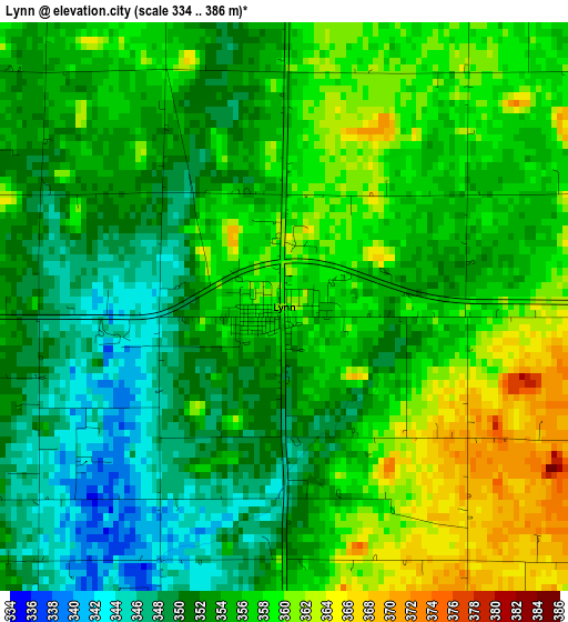
Below is the Elevation map of Lynn, which displays elevation range with different colors. Scale of the first map is from 334 to 386 m (1096 to 1266 ft) with average elevation of 354.5 meters (=1163 ft) [note 1]
These maps also provides idea of topography and contour of this city, they are displayed at different zoom levels. More info about maps, scale and edge coordinates you can find below images.
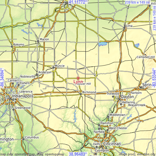
| \ | Map #1 | Topo.Map |
| Scale [m] | 334..386 m | × |
| Scale [ft] | 1096..1266 ft | × |
| Average | 354.5 m = 1163 ft | × |
| Width | 7.48 km = 4.6 mi | 239.4 km = 148.8 mi |
| Height | 7.48 km = 4.6 mi | 239.4 km = 148.8 mi |
| ↑Max Latitude | 40.083401° | 41.11772° |
| Latitude at center | 40.04977° | 40.04977° |
| ↓Min Latitude | 40.016122° | 38.96483° |
| ← Min Longitude | -84.983635° | -86.34594° |
| Longitude center | -84.93969° | -84.93969° |
| →Max Longitude | -84.895745° | -83.53344° |
Nearby cities:
Cities around Lynn sort by population:
• Richmond elevation 300 m
24.9 km,  170°
170°
• Greenville 319 m
26.8 km,  77°
77°
• Winchester 336 m
14 km,  345°
345°
• Union City 347 m
20.2 km,  33°
33°
• Centerville 309 m
26.2 km,  190°
190°
• Cambridge City 285 m
33 km,  216°
216°
• Hagerstown 307 m
24.4 km,  230°
230°
• Union City 321 m
20.3 km, 34°
• New Paris 315 m
24.8 km,  149°
149°
• Parker City 313 m
27.3 km,  304°
304°
• Farmland 316 m
22.1 km,  313°
313°
• Ansonia 304 m
31.6 km,  54°
54°
Multilingual:
 En español:
Lynn elevación 359 m.
 En France:
Lynn élévation 359 m.


Sources and notes:
- [note 1] Map square and city borders are not equal. Map elevation data is calculated only from area inside that square.
- [src 1] Elevation data from geonames database provided with same terms of usage.
- [src 2] The elevation map of Lynn is generated using elevation data from NASA's 3 arcsec (90m) resolution SRTM data.
- [src 3] Base (background) map © OpenStreetMap contributors tiles are generated by Geofabrik and OpenTopoMap.
Copyright & License:
This Lynn Elevation Map is licensed under CC BY-SA. You may reuse any part from this page, if you give a proper credit by linking to this URL:
 More info on terms of use page.