Carrollton elevation
Carrollton (Ohio, Carroll County), United States elevation is 337 meters and Carrollton elevation in feet is 1106 ft above sea level [src 1]. Carrollton is a seat of a second-order administrative division (feature code) with elevation that is 58 meters (190 ft) bigger than average city elevation in United States.
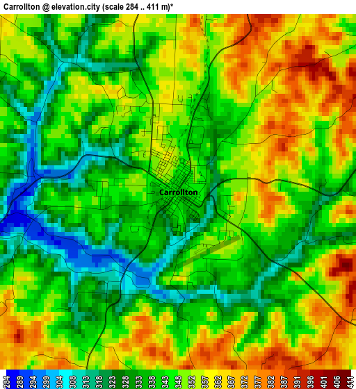
Below is the Elevation map of Carrollton, which displays elevation range with different colors. Scale of the first map is from 284 to 411 m (932 to 1348 ft) with average elevation of 346 meters (=1135 ft) [note 1]
These maps also provides idea of topography and contour of this city, they are displayed at different zoom levels. More info about maps, scale and edge coordinates you can find below images.
| \ | Map #1 | Topo.Map |
| Scale [m] | 284..411 m | × |
| Scale [ft] | 932..1348 ft | × |
| Average | 346 m = 1135 ft | × |
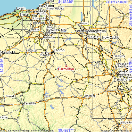
| Width | 7.42 km = 4.6 mi | 237.5 km = 147.6 mi |
| Height | 7.42 km = 4.6 mi | 237.5 km = 147.6 mi |
| ↑Max Latitude | 40.606212° | 41.63246° |
| Latitude at center | 40.57284° | 40.57284° |
| ↓Min Latitude | 40.539452° | 39.49617° |
| ← Min Longitude | -81.129595° | -82.4919° |
| Longitude center | -81.08565° | -81.08565° |
| →Max Longitude | -81.041705° | -79.6794° |
Nearby cities:
Cities around Carrollton sort by population:
• New Philadelphia elevation 277 m
31.8 km,  253°
253°
• Dover 271 m
33.3 km,  259°
259°
• Louisville 347 m
32.9 km,  333°
333°
• Uhrichsville 263 m
29.8 km,  227°
227°
• Minerva 323 m
17.5 km,  354°
354°
• Dennison 264 m
29 km, 226°
• Lake Mohawk 370 m
14.2 km,  317°
317°
• East Canton 357 m
29.1 km, 325°
• Salineville 279 m
21.6 km,  75°
75°
• Malvern 304 m
15.5 km, 328°
• Rockford 320 m
21.6 km,  240°
240°
• Tuscarawas 257 m
33.6 km, 233°
Multilingual:
 En español:
Carrollton elevación 337 m.
 En France:
Carrollton élévation 337 m.
 Auf Deutsch:
Carrollton höhe über dem Meeresspiegel ist 337 m.

Sources and notes:
- [note 1] Map square and city borders are not equal. Map elevation data is calculated only from area inside that square.
- [src 1] Elevation data from geonames database provided with same terms of usage.
- [src 2] The elevation map of Carrollton is generated using elevation data from NASA's 3 arcsec (90m) resolution SRTM data.
- [src 3] Base (background) map © OpenStreetMap contributors tiles are generated by Geofabrik and OpenTopoMap.
Copyright & License:
This Carrollton Elevation Map is licensed under CC BY-SA. You may reuse any part from this page, if you give a proper credit by linking to this URL:
 More info on terms of use page.