Dover elevation
Dover (Ohio, Tuscarawas County), United States elevation is 271 meters and Dover elevation in feet is 889 ft above sea level [src 1]. Dover is a populated place (feature code) with elevation that is 8 meters (26 ft) smaller than average city elevation in United States.
Below is the Elevation map of Dover, which displays elevation range with different colors. Scale of the first map is from 258 to 368 m (846 to 1207 ft) with average elevation of 286.4 meters (=940 ft) [note 1]
These maps also provides idea of topography and contour of this city, they are displayed at different zoom levels. More info about maps, scale and edge coordinates you can find below images.
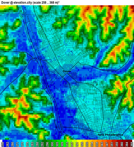
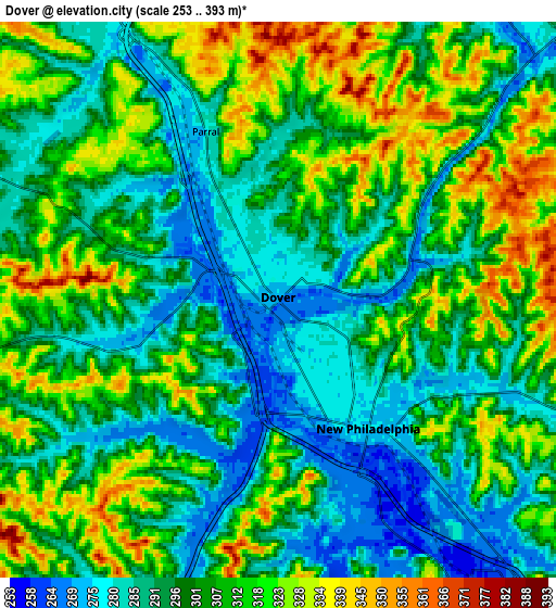
| \ | Map #1 | Map #2 | Topo.Map |
| Scale [m] | 258..368 m | 253..393 m | × |
| Scale [ft] | 846..1207 ft | 830..1289 ft | × |
| Average | 286.4 m = 940 ft | 302.7 m = 993 ft | × |
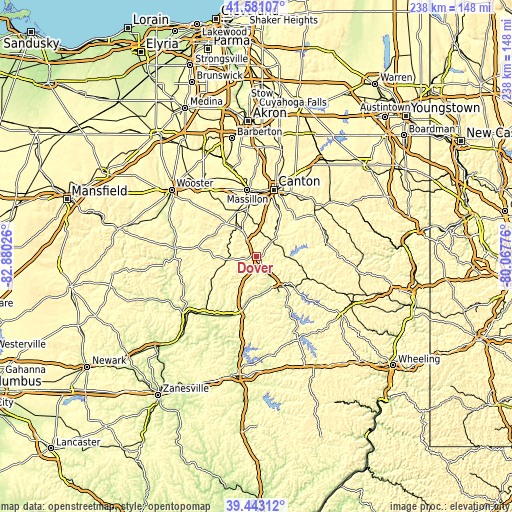
| Width | 7.43 km = 4.6 mi | 14.86 km = 9.2 mi | 237.7 km = 147.7 mi |
| Height | 7.43 km = 4.6 mi | 14.86 km = 9.2 mi | 237.7 km = 147.7 mi |
| ↑Max Latitude | 40.554018° | 40.587399° | 41.58107° |
| Latitude at center | 40.52062° | 40.52062° | 40.52062° |
| ↓Min Latitude | 40.487206° | 40.453775° | 39.44312° |
| ← Min Longitude | -81.517955° | -81.561901° | -82.88026° |
| Longitude center | -81.47401° | -81.47401° | -81.47401° |
| →Max Longitude | -81.430065° | -81.386119° | -80.06776° |
Nearby cities:
Cities around Dover sort by population:
• New Philadelphia elevation 277 m
4.2 km,  145°
145°
• Uhrichsville 263 m
17.8 km,  142°
142°
• Strasburg 279 m
9.4 km,  331°
331°
• Dennison 264 m
18.5 km, 140°
• Sugarcreek 305 m
14.2 km,  262°
262°
• Sugarcreek Police Dept 302 m
14.3 km, 261°
• Brewster 303 m
23.2 km, 333°
• Navarre 295 m
23 km,  349°
349°
• Gnadenhutten 259 m
18.3 km,  169°
169°
• Rockford 320 m
14.8 km,  109°
109°
• Tuscarawas 257 m
15.1 km,  157°
157°
• Beach City 310 m
17.3 km, 328°
Multilingual:
 En español:
Dover elevación 271 m.
 En France:
Dover élévation 271 m.


Sources and notes:
- [note 1] Map square and city borders are not equal. Map elevation data is calculated only from area inside that square.
- [src 1] Elevation data from geonames database provided with same terms of usage.
- [src 2] The elevation map of Dover is generated using elevation data from NASA's 3 arcsec (90m) resolution SRTM data.
- [src 3] Base (background) map © OpenStreetMap contributors tiles are generated by Geofabrik and OpenTopoMap.
Copyright & License:
This Dover Elevation Map is licensed under CC BY-SA. You may reuse any part from this page, if you give a proper credit by linking to this URL:
 More info on terms of use page.