West Point elevation
West Point (New York, Orange County), United States elevation is 54 meters and West Point elevation in feet is 177 ft above sea level [src 1]. West Point is a populated place (feature code) with elevation that is 225 meters (738 ft) smaller than average city elevation in United States.
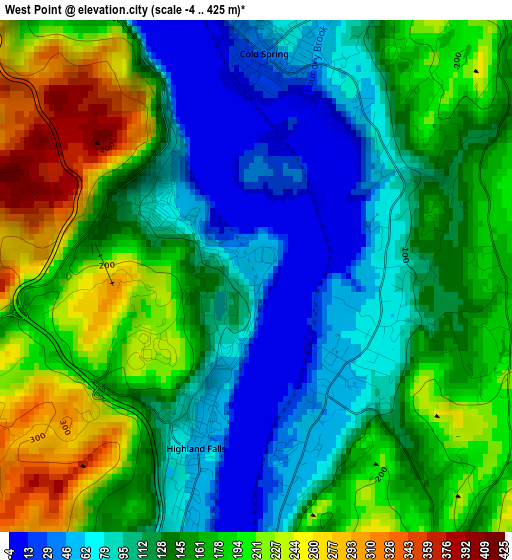
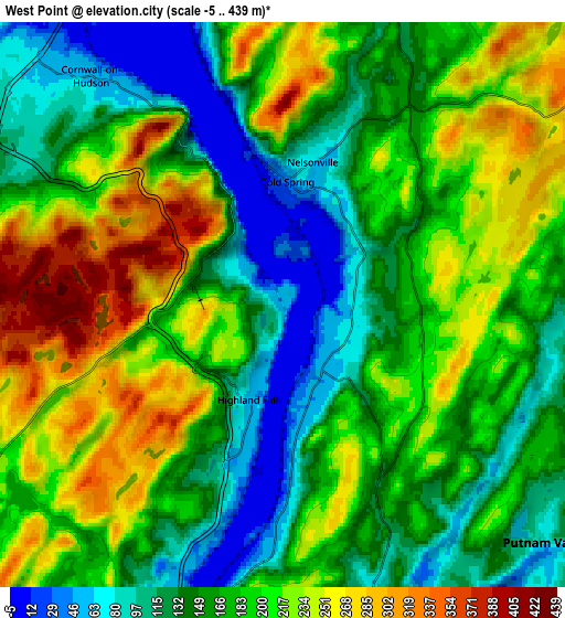
Below is the Elevation map of West Point, which displays elevation range with different colors. Scale of the first map is from -4 to 425 m (-13 to 1394 ft) with average elevation of 144.2 meters (=473 ft) [note 1]
These maps also provides idea of topography and contour of this city, they are displayed at different zoom levels. More info about maps, scale and edge coordinates you can find below images.
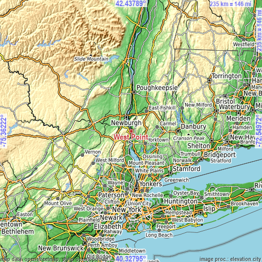
| \ | Map #1 | Map #2 | Topo.Map |
| Scale [m] | -4..425 m | -5..439 m | × |
| Scale [ft] | -13..1394 ft | -16..1440 ft | × |
| Average | 144.2 m = 473 ft | 179.1 m = 588 ft | × |
| Width | 7.33 km = 4.6 mi | 14.66 km = 9.1 mi | 234.6 km = 145.8 mi |
| Height | 7.33 km = 4.6 mi | 14.66 km = 9.1 mi | 234.6 km = 145.8 mi |
| ↑Max Latitude | 41.42444° | 41.457383° | 42.43789° |
| Latitude at center | 41.39148° | 41.39148° | 41.39148° |
| ↓Min Latitude | 41.358503° | 41.32551° | 40.32795° |
| ← Min Longitude | -73.999915° | -74.043861° | -75.36222° |
| Longitude center | -73.95597° | -73.95597° | -73.95597° |
| →Max Longitude | -73.912025° | -73.868079° | -72.54972° |
Nearby cities:
Cities around West Point sort by population:
• Peekskill elevation 49 m
11.7 km,  165°
165°
• Beacon 44 m
12.7 km,  354°
354°
• Woodbury 146 m
12.9 km,  256°
256°
• New Windsor 54 m
11 km,  329°
329°
• Lake Mohegan 161 m
12.3 km,  131°
131°
• Firthcliffe 93 m
9.1 km,  305°
305°
• Highland Falls 53 m
2.6 km,  199°
199°
• Vails Gate 88 m
11 km, 309°
• Cornwall 54 m
7.7 km,  319°
319°
• Crompond 131 m
13.1 km,  144°
144°
• Cold Spring 41 m
3.2 km,  2°
2°
• Fort Montgomery 55 m
7.2 km, 201°
Multilingual:
 En español:
West Point elevación 54 m.
 En France:
West Point élévation 54 m.
 Auf Deutsch:
West Point höhe über dem Meeresspiegel ist 54 m.

Sources and notes:
- [note 1] Map square and city borders are not equal. Map elevation data is calculated only from area inside that square.
- [src 1] Elevation data from geonames database provided with same terms of usage.
- [src 2] The elevation map of West Point is generated using elevation data from NASA's 3 arcsec (90m) resolution SRTM data.
- [src 3] Base (background) map © OpenStreetMap contributors tiles are generated by Geofabrik and OpenTopoMap.
Copyright & License:
This West Point Elevation Map is licensed under CC BY-SA. You may reuse any part from this page, if you give a proper credit by linking to this URL:
 More info on terms of use page.