Viola elevation
Viola (New York, Rockland County), United States elevation is 179 meters and Viola elevation in feet is 587 ft above sea level [src 1]. Viola is a populated place (feature code) with elevation that is 100 meters (328 ft) smaller than average city elevation in United States.
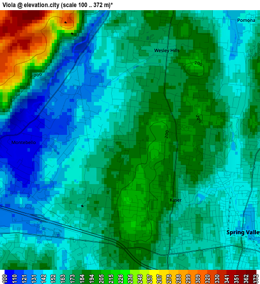
Below is the Elevation map of Viola, which displays elevation range with different colors. Scale of the first map is from 100 to 372 m (328 to 1220 ft) with average elevation of 170.4 meters (=559 ft) [note 1]
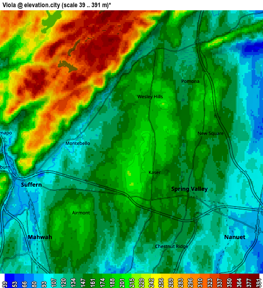
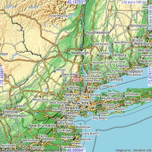
These maps also provides idea of topography and contour of this city, they are displayed at different zoom levels. More info about maps, scale and edge coordinates you can find below images.
| \ | Map #1 | Map #2 | Topo.Map |
| Scale [m] | 100..372 m | 39..391 m | × |
| Scale [ft] | 328..1220 ft | 128..1283 ft | × |
| Average | 170.4 m = 559 ft | 170.4 m = 559 ft | × |
| Width | 7.36 km = 4.6 mi | 14.72 km = 9.1 mi | 235.5 km = 146.3 mi |
| Height | 7.36 km = 4.6 mi | 14.72 km = 9.1 mi | 235.5 km = 146.3 mi |
| ↑Max Latitude | 41.169569° | 41.202641° | 42.18703° |
| Latitude at center | 41.13648° | 41.13648° | 41.13648° |
| ↓Min Latitude | 41.103374° | 41.070252° | 40.06884° |
| ← Min Longitude | -74.126305° | -74.170251° | -75.48861° |
| Longitude center | -74.08236° | -74.08236° | -74.08236° |
| →Max Longitude | -74.038415° | -73.994469° | -72.67611° |
Nearby cities:
Cities around Viola sort by population:
• Spring Valley elevation 139 m
4.1 km,  128°
128°
• Monsey 167 m
3 km,  157°
157°
• Suffern 99 m
6.1 km,  246°
246°
• Airmont 183 m
4.9 km,  215°
215°
• Chestnut Ridge 127 m
6.2 km, 158°
• New Square 152 m
4.4 km,  85°
85°
• Hillcrest 159 m
3.6 km,  105°
105°
• Wesley Hills 169 m
2.7 km,  22°
22°
• New Hempstead 183 m
4.3 km,  69°
69°
• Kaser 174 m
2.1 km,  143°
143°
• Montebello 104 m
3 km,  268°
268°
• Pomona 149 m
4.7 km,  43°
43°
Multilingual:
 En español:
Viola elevación 179 m.
 En France:
Viola élévation 179 m.


Sources and notes:
- [note 1] Map square and city borders are not equal. Map elevation data is calculated only from area inside that square.
- [src 1] Elevation data from geonames database provided with same terms of usage.
- [src 2] The elevation map of Viola is generated using elevation data from NASA's 3 arcsec (90m) resolution SRTM data.
- [src 3] Base (background) map © OpenStreetMap contributors tiles are generated by Geofabrik and OpenTopoMap.
Copyright & License:
This Viola Elevation Map is licensed under CC BY-SA. You may reuse any part from this page, if you give a proper credit by linking to this URL:
 More info on terms of use page.