Owego elevation
Owego (New York, Tioga County), United States elevation is 251 meters and Owego elevation in feet is 823 ft above sea level [src 1]. Owego is a seat of a second-order administrative division (feature code) with elevation that is 28 meters (92 ft) smaller than average city elevation in United States.
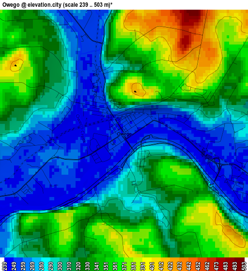
Below is the Elevation map of Owego, which displays elevation range with different colors. Scale of the first map is from 239 to 503 m (784 to 1650 ft) with average elevation of 316 meters (=1037 ft) [note 1]
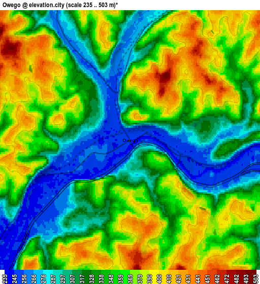
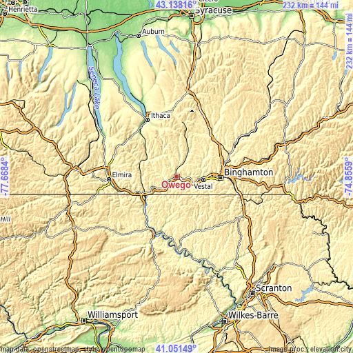
These maps also provides idea of topography and contour of this city, they are displayed at different zoom levels. More info about maps, scale and edge coordinates you can find below images.
| \ | Map #1 | Map #2 | Topo.Map |
| Scale [m] | 239..503 m | 235..503 m | × |
| Scale [ft] | 784..1650 ft | 771..1650 ft | × |
| Average | 316 m = 1037 ft | 344.8 m = 1131 ft | × |
| Width | 7.25 km = 4.5 mi | 14.5 km = 9 mi | 232 km = 144.2 mi |
| Height | 7.25 km = 4.5 mi | 14.5 km = 9 mi | 232 km = 144.2 mi |
| ↑Max Latitude | 42.136006° | 42.168586° | 43.13816° |
| Latitude at center | 42.10341° | 42.10341° | 42.10341° |
| ↓Min Latitude | 42.070797° | 42.038167° | 41.05149° |
| ← Min Longitude | -76.306095° | -76.350041° | -77.6684° |
| Longitude center | -76.26215° | -76.26215° | -76.26215° |
| →Max Longitude | -76.218205° | -76.174259° | -74.8559° |
Nearby cities:
Cities around Owego sort by population:
• Binghamton elevation 267 m
28.4 km,  91°
91°
• Johnson City 267 m
25.1 km, 86°
• Endicott 258 m
17.6 km, 91°
• Endwell 260 m
19.9 km, 86°
• Sayre 238 m
25.1 km,  236°
236°
• Waverly 251 m
24.2 km, 244°
• Athens 233 m
26.7 km,  232°
232°
• Chenango Bridge 273 m
33.7 km,  77°
77°
• Towanda 223 m
40.2 km,  201°
201°
• Port Dickinson 263 m
30.4 km, 83°
• Apalachin 259 m
9.6 km,  113°
113°
• South Waverly 252 m
25.6 km, 242°
Multilingual:
 En español:
Owego elevación 251 m.
 En France:
Owego élévation 251 m.


Sources and notes:
- [note 1] Map square and city borders are not equal. Map elevation data is calculated only from area inside that square.
- [src 1] Elevation data from geonames database provided with same terms of usage.
- [src 2] The elevation map of Owego is generated using elevation data from NASA's 3 arcsec (90m) resolution SRTM data.
- [src 3] Base (background) map © OpenStreetMap contributors tiles are generated by Geofabrik and OpenTopoMap.
Copyright & License:
This Owego Elevation Map is licensed under CC BY-SA. You may reuse any part from this page, if you give a proper credit by linking to this URL:
 More info on terms of use page.