Florida elevation
Florida (New York, Orange County), United States elevation is 139 meters and Florida elevation in feet is 456 ft above sea level [src 1]. Florida is a populated place (feature code) with elevation that is 140 meters (459 ft) smaller than average city elevation in United States.
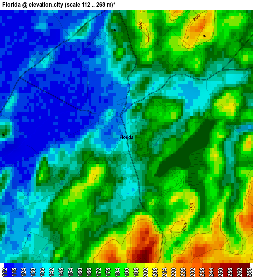
Below is the Elevation map of Florida, which displays elevation range with different colors. Scale of the first map is from 112 to 268 m (367 to 879 ft) with average elevation of 158.1 meters (=519 ft) [note 1]
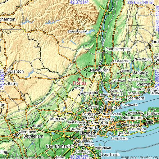
These maps also provides idea of topography and contour of this city, they are displayed at different zoom levels. More info about maps, scale and edge coordinates you can find below images.
| \ | Map #1 | Topo.Map |
| Scale [m] | 112..268 m | × |
| Scale [ft] | 367..879 ft | × |
| Average | 158.1 m = 519 ft | × |
| Width | 7.34 km = 4.6 mi | 234.8 km = 145.9 mi |
| Height | 7.34 km = 4.6 mi | 234.8 km = 145.9 mi |
| ↑Max Latitude | 41.36475° | 42.37914° |
| Latitude at center | 41.33176° | 41.33176° |
| ↓Min Latitude | 41.298753° | 40.26727° |
| ← Min Longitude | -74.400765° | -75.76307° |
| Longitude center | -74.35682° | -74.35682° |
| →Max Longitude | -74.312875° | -72.95057° |
Nearby cities:
Cities around Florida sort by population:
• Middletown elevation 171 m
13.8 km,  336°
336°
• Kiryas Joel 210 m
15.8 km,  85°
85°
• Monroe 199 m
14.2 km, 90°
• Mechanicstown 169 m
12.6 km,  347°
347°
• Warwick 160 m
8.4 km,  181°
181°
• Goshen 133 m
8.3 km,  19°
19°
• Chester 145 m
7.9 km,  64°
64°
• Eden 122 m
12.4 km,  247°
247°
• South Blooming Grove 172 m
15.6 km,  72°
72°
• Greenwood Lake 194 m
13.2 km,  156°
156°
• Walton Park 262 m
10.9 km,  102°
102°
• Vernon Valley 198 m
15.2 km,  225°
225°
Multilingual:
 En español:
Florida elevación 139 m.
 En France:
Florida élévation 139 m.


Sources and notes:
- [note 1] Map square and city borders are not equal. Map elevation data is calculated only from area inside that square.
- [src 1] Elevation data from geonames database provided with same terms of usage.
- [src 2] The elevation map of Florida is generated using elevation data from NASA's 3 arcsec (90m) resolution SRTM data.
- [src 3] Base (background) map © OpenStreetMap contributors tiles are generated by Geofabrik and OpenTopoMap.
Copyright & License:
This Florida Elevation Map is licensed under CC BY-SA. You may reuse any part from this page, if you give a proper credit by linking to this URL:
 More info on terms of use page.