Congers elevation
Congers (New York, Rockland County), United States elevation is 64 meters and Congers elevation in feet is 210 ft above sea level [src 1]. Congers is a populated place (feature code) with elevation that is 215 meters (705 ft) smaller than average city elevation in United States.
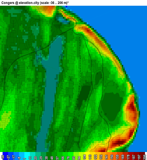
Below is the Elevation map of Congers, which displays elevation range with different colors. Scale of the first map is from -36 to 206 m (-118 to 676 ft) with average elevation of 49.6 meters (=163 ft) [note 1]
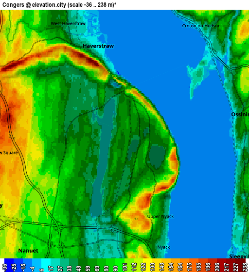
These maps also provides idea of topography and contour of this city, they are displayed at different zoom levels. More info about maps, scale and edge coordinates you can find below images.
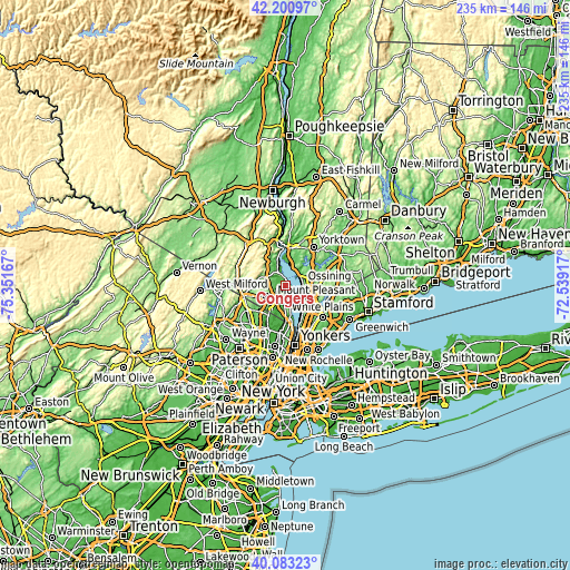
| \ | Map #1 | Map #2 | Topo.Map |
| Scale [m] | -36..206 m | -36..238 m | × |
| Scale [ft] | -118..676 ft | -118..781 ft | × |
| Average | 49.6 m = 163 ft | 56 m = 184 ft | × |
| Width | 7.36 km = 4.6 mi | 14.72 km = 9.1 mi | 235.5 km = 146.3 mi |
| Height | 7.36 km = 4.6 mi | 14.72 km = 9.1 mi | 235.5 km = 146.3 mi |
| ↑Max Latitude | 41.183732° | 41.216797° | 42.20097° |
| Latitude at center | 41.15065° | 41.15065° | 41.15065° |
| ↓Min Latitude | 41.117552° | 41.084437° | 40.08323° |
| ← Min Longitude | -73.989365° | -74.033311° | -75.35167° |
| Longitude center | -73.94542° | -73.94542° | -73.94542° |
| →Max Longitude | -73.901475° | -73.857529° | -72.53917° |
Nearby cities:
Cities around Congers sort by population:
• New City elevation 53 m
3.7 km,  264°
264°
• Ossining 57 m
7.2 km,  79°
79°
• Haverstraw 13 m
5.5 km,  342°
342°
• West Haverstraw 39 m
7.4 km,  332°
332°
• Valley Cottage 61 m
3.7 km,  193°
193°
• New Square 152 m
7.1 km, 260°
• Nyack 26 m
7.1 km,  160°
160°
• New Hempstead 183 m
7.4 km,  269°
269°
• Bardonia 96 m
6.2 km,  222°
222°
• South Nyack 29 m
7.8 km, 164°
• West Nyack 27 m
6.4 km,  200°
200°
• Upper Nyack 62 m
5.3 km, 156°
Multilingual:
 En español:
Congers elevación 64 m.
 En France:
Congers élévation 64 m.


Sources and notes:
- [note 1] Map square and city borders are not equal. Map elevation data is calculated only from area inside that square.
- [src 1] Elevation data from geonames database provided with same terms of usage.
- [src 2] The elevation map of Congers is generated using elevation data from NASA's 3 arcsec (90m) resolution SRTM data.
- [src 3] Base (background) map © OpenStreetMap contributors tiles are generated by Geofabrik and OpenTopoMap.
Copyright & License:
This Congers Elevation Map is licensed under CC BY-SA. You may reuse any part from this page, if you give a proper credit by linking to this URL:
 More info on terms of use page.