Alfred elevation
Alfred (New York, Allegany County), United States elevation is 542 meters and Alfred elevation in feet is 1778 ft above sea level [src 1]. Alfred is a populated place (feature code) with elevation that is 263 meters (863 ft) bigger than average city elevation in United States.
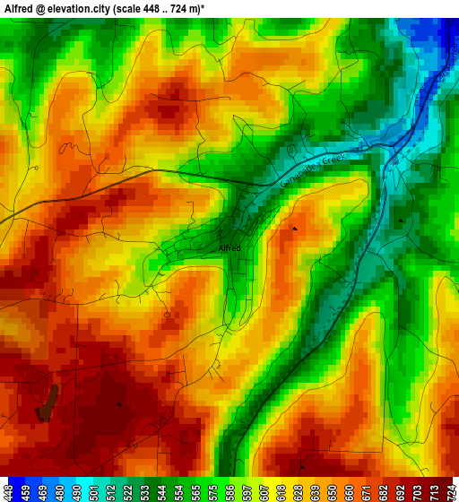
Below is the Elevation map of Alfred, which displays elevation range with different colors. Scale of the first map is from 448 to 724 m (1470 to 2375 ft) with average elevation of 613.3 meters (=2012 ft) [note 1]
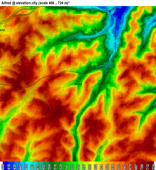
These maps also provides idea of topography and contour of this city, they are displayed at different zoom levels. More info about maps, scale and edge coordinates you can find below images.
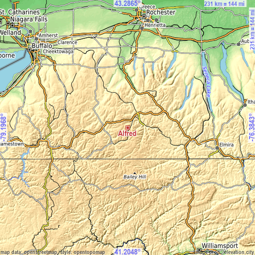
| \ | Map #1 | Map #2 | Topo.Map |
| Scale [m] | 448..724 m | 406..724 m | × |
| Scale [ft] | 1470..2375 ft | 1332..2375 ft | × |
| Average | 613.3 m = 2012 ft | 618.7 m = 2030 ft | × |
| Width | 7.23 km = 4.5 mi | 14.47 km = 9 mi | 231.5 km = 143.8 mi |
| Height | 7.23 km = 4.5 mi | 14.47 km = 9 mi | 231.5 km = 143.8 mi |
| ↑Max Latitude | 42.286759° | 42.31926° | 43.2865° |
| Latitude at center | 42.25424° | 42.25424° | 42.25424° |
| ↓Min Latitude | 42.221705° | 42.189153° | 41.2048° |
| ← Min Longitude | -77.834495° | -77.878441° | -79.1968° |
| Longitude center | -77.79055° | -77.79055° | -77.79055° |
| →Max Longitude | -77.746605° | -77.702659° | -76.3843° |
Nearby cities:
Cities around Alfred sort by population:
• Hornell elevation 356 m
13.4 km,  52°
52°
• Bath 340 m
40 km,  76°
76°
• Dansville 218 m
35 km,  12°
12°
• Wellsville 461 m
19.6 km,  221°
221°
• Canisteo 348 m
15.3 km, 83°
• Wayland 418 m
38.6 km,  25°
25°
• Houghton 371 m
35.5 km,  301°
301°
• Nunda 289 m
38.3 km,  340°
340°
• Friendship 465 m
29.1 km,  259°
259°
• Andover 509 m
10.9 km,  182°
182°
• Bolivar 490 m
37.4 km,  236°
236°
• Belmont 423 m
20.4 km, 260°
Multilingual:
 En español:
Alfred elevación 542 m.
 En France:
Alfred élévation 542 m.


Sources and notes:
- [note 1] Map square and city borders are not equal. Map elevation data is calculated only from area inside that square.
- [src 1] Elevation data from geonames database provided with same terms of usage.
- [src 2] The elevation map of Alfred is generated using elevation data from NASA's 3 arcsec (90m) resolution SRTM data.
- [src 3] Base (background) map © OpenStreetMap contributors tiles are generated by Geofabrik and OpenTopoMap.
Copyright & License:
This Alfred Elevation Map is licensed under CC BY-SA. You may reuse any part from this page, if you give a proper credit by linking to this URL:
 More info on terms of use page.