Lawrenceville elevation
Lawrenceville (New Jersey, Mercer County), United States elevation is 43 meters and Lawrenceville elevation in feet is 141 ft above sea level [src 1]. Lawrenceville is a populated place (feature code) with elevation that is 236 meters (774 ft) smaller than average city elevation in United States.
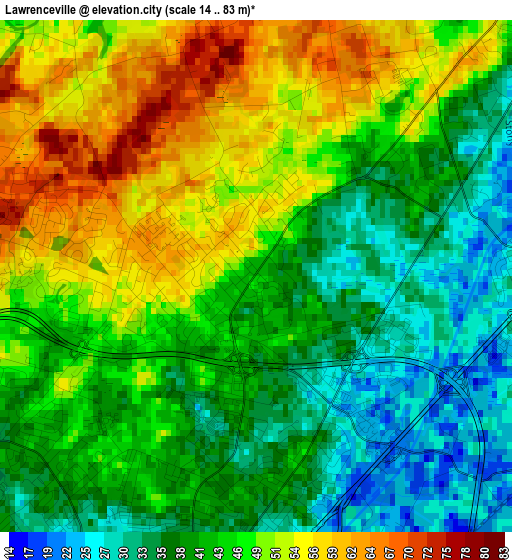
Below is the Elevation map of Lawrenceville, which displays elevation range with different colors. Scale of the first map is from 14 to 83 m (46 to 272 ft) with average elevation of 44.1 meters (=145 ft) [note 1]
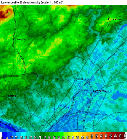
These maps also provides idea of topography and contour of this city, they are displayed at different zoom levels. More info about maps, scale and edge coordinates you can find below images.
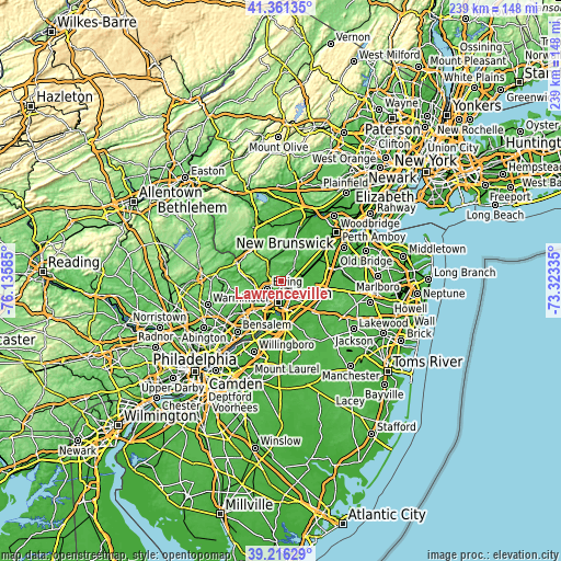
| \ | Map #1 | Map #2 | Topo.Map |
| Scale [m] | 14..83 m | 1..140 m | × |
| Scale [ft] | 46..272 ft | 3..459 ft | × |
| Average | 44.1 m = 145 ft | 43.4 m = 142 ft | × |
| Width | 7.45 km = 4.6 mi | 14.91 km = 9.3 mi | 238.5 km = 148.2 mi |
| Height | 7.45 km = 4.6 mi | 14.91 km = 9.3 mi | 238.5 km = 148.2 mi |
| ↑Max Latitude | 40.330839° | 40.364331° | 41.36135° |
| Latitude at center | 40.29733° | 40.29733° | 40.29733° |
| ↓Min Latitude | 40.263805° | 40.230263° | 39.21629° |
| ← Min Longitude | -74.773545° | -74.817491° | -76.13585° |
| Longitude center | -74.7296° | -74.7296° | -74.7296° |
| →Max Longitude | -74.685655° | -74.641709° | -73.32335° |
Nearby cities:
Cities around Lawrenceville sort by population:
• Trenton elevation 23 m
9 km,  187°
187°
• Ewing 56 m
6.7 km,  242°
242°
• Princeton 72 m
8.3 km,  46°
46°
• Mercerville-Hamilton Square 38 m
8.8 km,  146°
146°
• Mercerville 30 m
7.6 km, 151°
• Hamilton Square 37 m
10.1 km,  140°
140°
• Morrisville 38 m
10.8 km,  207°
207°
• Prospect Park 29 m
7.1 km, 206°
• Pennington 69 m
6.2 km,  303°
303°
• Princeton Junction 27 m
9.6 km,  76°
76°
• Yardley 26 m
11.4 km, 239°
• Hopewell 64 m
10.6 km,  345°
345°
Multilingual:
 En español:
Lawrenceville elevación 43 m.
 En France:
Lawrenceville élévation 43 m.
 Auf Deutsch:
Lawrenceville höhe über dem Meeresspiegel ist 43 m.

Sources and notes:
- [note 1] Map square and city borders are not equal. Map elevation data is calculated only from area inside that square.
- [src 1] Elevation data from geonames database provided with same terms of usage.
- [src 2] The elevation map of Lawrenceville is generated using elevation data from NASA's 3 arcsec (90m) resolution SRTM data.
- [src 3] Base (background) map © OpenStreetMap contributors tiles are generated by Geofabrik and OpenTopoMap.
Copyright & License:
This Lawrenceville Elevation Map is licensed under CC BY-SA. You may reuse any part from this page, if you give a proper credit by linking to this URL:
 More info on terms of use page.