Hardwick elevation
Hardwick (New Jersey, Warren County), United States elevation is 261 meters and Hardwick elevation in feet is 856 ft above sea level [src 1]. Hardwick is a populated place (feature code) with elevation that is 18 meters (59 ft) smaller than average city elevation in United States.
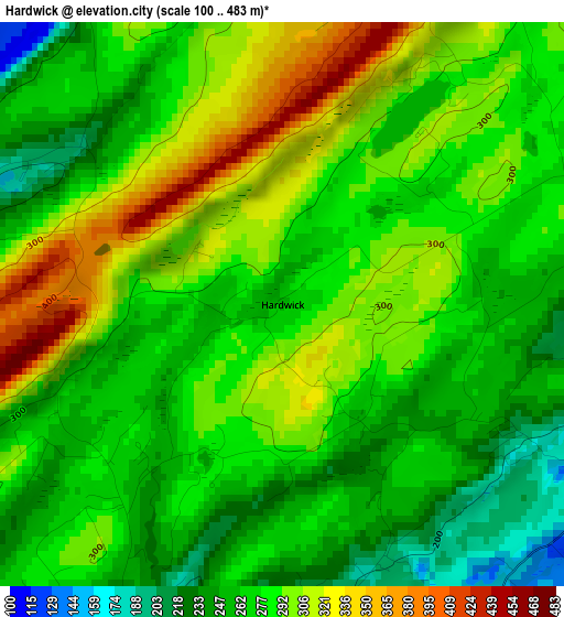
Below is the Elevation map of Hardwick, which displays elevation range with different colors. Scale of the first map is from 100 to 483 m (328 to 1585 ft) with average elevation of 282.1 meters (=926 ft) [note 1]
These maps also provides idea of topography and contour of this city, they are displayed at different zoom levels. More info about maps, scale and edge coordinates you can find below images.
| \ | Map #1 | Topo.Map |
| Scale [m] | 100..483 m | × |
| Scale [ft] | 328..1585 ft | × |
| Average | 282.1 m = 926 ft | × |
| Width | 7.37 km = 4.6 mi | 235.8 km = 146.5 mi |
| Height | 7.37 km = 4.6 mi | 235.8 km = 146.5 mi |
| ↑Max Latitude | 41.08767° | 42.10641° |
| Latitude at center | 41.05454° | 41.05454° |
| ↓Min Latitude | 41.021393° | 39.98558° |
| ← Min Longitude | -74.976065° | -76.33837° |
| Longitude center | -74.93212° | -74.93212° |
| →Max Longitude | -74.888175° | -73.52587° |
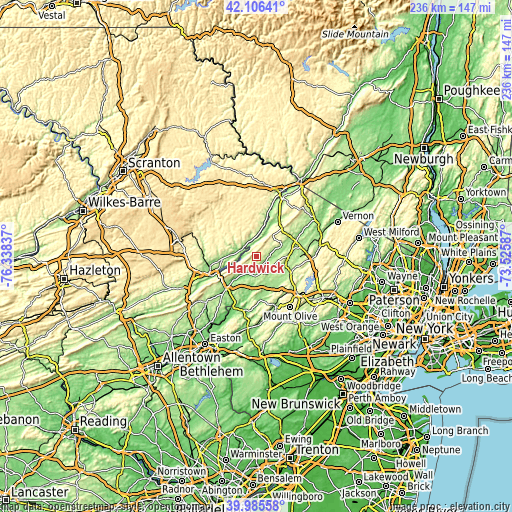
Nearby cities:
Cities around Hardwick sort by population:
• Sparta elevation 227 m
24.7 km,  95°
95°
• East Stroudsburg 134 m
21.8 km,  253°
253°
• Lake Mohawk 235 m
23.2 km, 99°
• Hackettstown 173 m
23.9 km,  158°
158°
• Newton 198 m
15.1 km,  88°
88°
• Arlington Heights 154 m
24.9 km, 253°
• Stroudsburg 136 m
23.3 km, 251°
• Saw Creek 230 m
11.9 km,  302°
302°
• Pine Ridge 393 m
11.3 km,  334°
334°
• Birchwood Lakes 354 m
22.3 km,  2°
2°
• Crandon Lakes 268 m
10.9 km,  44°
44°
• Pocono Ranch Lands 293 m
12.3 km,  352°
352°
Multilingual:
 En español:
Hardwick elevación 261 m.
 En France:
Hardwick élévation 261 m.
 Auf Deutsch:
Hardwick höhe über dem Meeresspiegel ist 261 m.

Sources and notes:
- [note 1] Map square and city borders are not equal. Map elevation data is calculated only from area inside that square.
- [src 1] Elevation data from geonames database provided with same terms of usage.
- [src 2] The elevation map of Hardwick is generated using elevation data from NASA's 3 arcsec (90m) resolution SRTM data.
- [src 3] Base (background) map © OpenStreetMap contributors tiles are generated by Geofabrik and OpenTopoMap.
Copyright & License:
This Hardwick Elevation Map is licensed under CC BY-SA. You may reuse any part from this page, if you give a proper credit by linking to this URL:
 More info on terms of use page.