Boonton elevation
Boonton (New Jersey, Morris County), United States elevation is 125 meters and Boonton elevation in feet is 410 ft above sea level [src 1]. Boonton is a populated place (feature code) with elevation that is 154 meters (505 ft) smaller than average city elevation in United States.
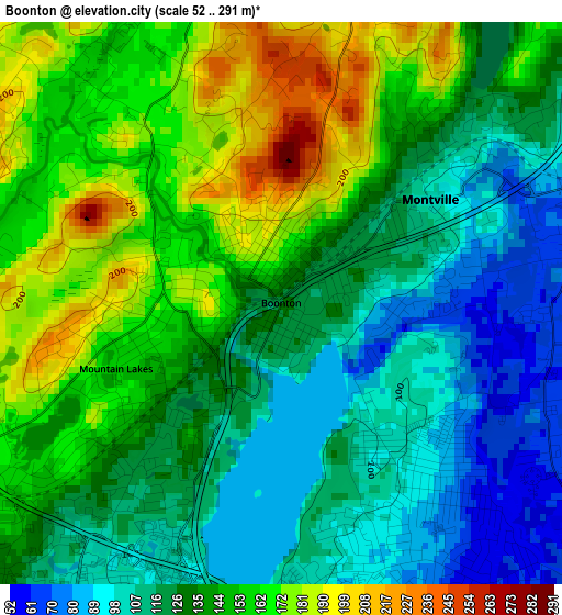
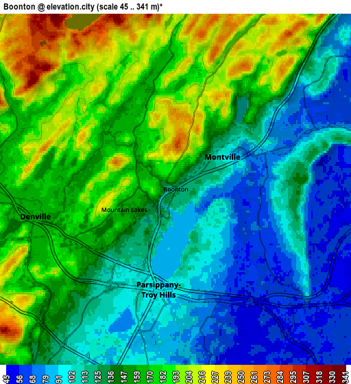
Below is the Elevation map of Boonton, which displays elevation range with different colors. Scale of the first map is from 52 to 291 m (171 to 955 ft) with average elevation of 136 meters (=446 ft) [note 1]
These maps also provides idea of topography and contour of this city, they are displayed at different zoom levels. More info about maps, scale and edge coordinates you can find below images.
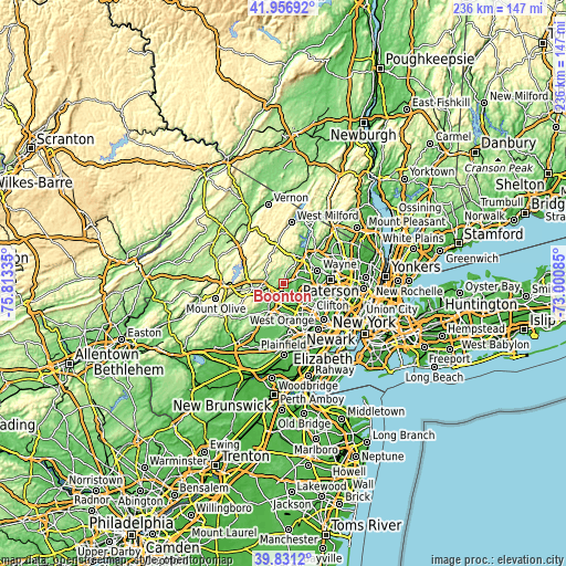
| \ | Map #1 | Map #2 | Topo.Map |
| Scale [m] | 52..291 m | 45..341 m | × |
| Scale [ft] | 171..955 ft | 148..1119 ft | × |
| Average | 136 m = 446 ft | 142 m = 466 ft | × |
| Width | 7.39 km = 4.6 mi | 14.77 km = 9.2 mi | 236.4 km = 146.9 mi |
| Height | 7.39 km = 4.6 mi | 14.77 km = 9.2 mi | 236.4 km = 146.9 mi |
| ↑Max Latitude | 40.935807° | 40.968996° | 41.95692° |
| Latitude at center | 40.9026° | 40.9026° | 40.9026° |
| ↓Min Latitude | 40.869377° | 40.836137° | 39.8312° |
| ← Min Longitude | -74.451045° | -74.494991° | -75.81335° |
| Longitude center | -74.4071° | -74.4071° | -74.4071° |
| →Max Longitude | -74.363155° | -74.319209° | -73.00085° |
Nearby cities:
Cities around Boonton sort by population:
• Wayne elevation 56 m
11.3 km,  76°
76°
• Parsippany 107 m
5.2 km,  197°
197°
• East Hanover 71 m
9.8 km,  158°
158°
• Lincoln Park 56 m
9.1 km,  74°
74°
• White Meadow Lake 234 m
9 km,  285°
285°
• Fairfield 57 m
8.8 km,  103°
103°
• Rockaway 174 m
9 km,  269°
269°
• Morris Plains 120 m
10.9 km,  214°
214°
• Westville 61 m
11.1 km,  125°
125°
• Mountain Lakes 161 m
2.3 km,  248°
248°
• Lake Telemark 222 m
9.7 km,  308°
308°
• West Caldwell 59 m
11 km,  122°
122°
Multilingual:
 En español:
Boonton elevación 125 m.
 En France:
Boonton élévation 125 m.


Sources and notes:
- [note 1] Map square and city borders are not equal. Map elevation data is calculated only from area inside that square.
- [src 1] Elevation data from geonames database provided with same terms of usage.
- [src 2] The elevation map of Boonton is generated using elevation data from NASA's 3 arcsec (90m) resolution SRTM data.
- [src 3] Base (background) map © OpenStreetMap contributors tiles are generated by Geofabrik and OpenTopoMap.
Copyright & License:
This Boonton Elevation Map is licensed under CC BY-SA. You may reuse any part from this page, if you give a proper credit by linking to this URL:
 More info on terms of use page.