Westville elevation
Westville (New Jersey, Essex County), United States elevation is 61 meters and Westville elevation in feet is 200 ft above sea level [src 1]. Westville is a populated place (feature code) with elevation that is 218 meters (715 ft) smaller than average city elevation in United States.
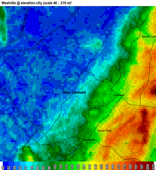
Below is the Elevation map of Westville, which displays elevation range with different colors. Scale of the first map is from 46 to 210 m (151 to 689 ft) with average elevation of 91 meters (=299 ft) [note 1]
These maps also provides idea of topography and contour of this city, they are displayed at different zoom levels. More info about maps, scale and edge coordinates you can find below images.
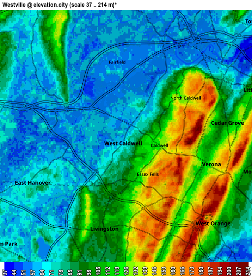
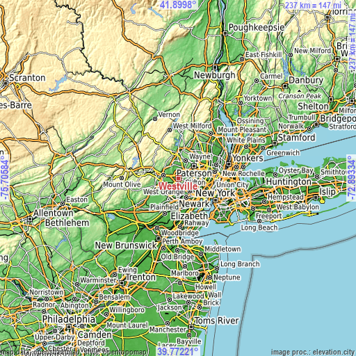
| \ | Map #1 | Map #2 | Topo.Map |
| Scale [m] | 46..210 m | 37..214 m | × |
| Scale [ft] | 151..689 ft | 121..702 ft | × |
| Average | 91 m = 299 ft | 89.7 m = 294 ft | × |
| Width | 7.39 km = 4.6 mi | 14.79 km = 9.2 mi | 236.6 km = 147 mi |
| Height | 7.39 km = 4.6 mi | 14.79 km = 9.2 mi | 236.6 km = 147 mi |
| ↑Max Latitude | 40.877776° | 40.910995° | 41.8998° |
| Latitude at center | 40.84454° | 40.84454° | 40.84454° |
| ↓Min Latitude | 40.811288° | 40.778019° | 39.77221° |
| ← Min Longitude | -74.343535° | -74.387481° | -75.70584° |
| Longitude center | -74.29959° | -74.29959° | -74.29959° |
| →Max Longitude | -74.255645° | -74.211699° | -72.89334° |
Nearby cities:
Cities around Westville sort by population:
• West Orange elevation 141 m
7.2 km,  135°
135°
• Livingston 98 m
5.6 km,  193°
193°
• Verona 130 m
5.3 km,  108°
108°
• Cedar Grove 95 m
6 km,  82°
82°
• East Hanover 71 m
6.1 km,  243°
243°
• Caldwell 124 m
2 km, 105°
• Fairfield 57 m
4.4 km,  352°
352°
• North Caldwell 136 m
4.1 km,  57°
57°
• Roseland 110 m
2.7 km,  169°
169°
• Singac 52 m
6.8 km,  46°
46°
• Essex Fells 152 m
2.6 km,  150°
150°
• West Caldwell 59 m
0.5 km,  26°
26°
Multilingual:
 En español:
Westville elevación 61 m.
 En France:
Westville élévation 61 m.
 Auf Deutsch:
Westville höhe über dem Meeresspiegel ist 61 m.

Sources and notes:
- [note 1] Map square and city borders are not equal. Map elevation data is calculated only from area inside that square.
- [src 1] Elevation data from geonames database provided with same terms of usage.
- [src 2] The elevation map of Westville is generated using elevation data from NASA's 3 arcsec (90m) resolution SRTM data.
- [src 3] Base (background) map © OpenStreetMap contributors tiles are generated by Geofabrik and OpenTopoMap.
Copyright & License:
This Westville Elevation Map is licensed under CC BY-SA. You may reuse any part from this page, if you give a proper credit by linking to this URL:
 More info on terms of use page.