Gilford elevation
Gilford (New Hampshire, Belknap County), United States elevation is 228 meters and Gilford elevation in feet is 748 ft above sea level [src 1]. Gilford is a populated place (feature code) with elevation that is 51 meters (167 ft) smaller than average city elevation in United States.
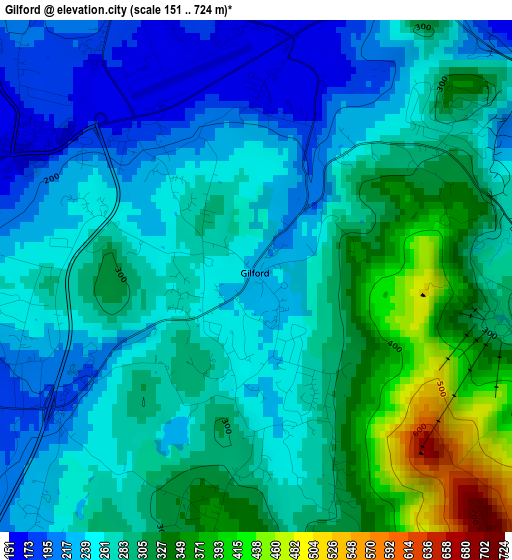
Below is the Elevation map of Gilford, which displays elevation range with different colors. Scale of the first map is from 151 to 724 m (495 to 2375 ft) with average elevation of 279.6 meters (=917 ft) [note 1]
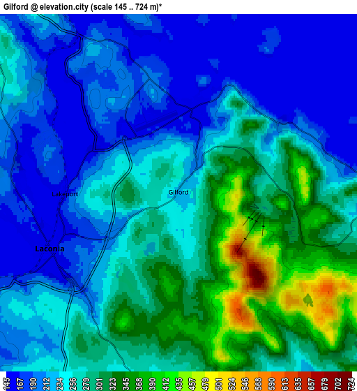
These maps also provides idea of topography and contour of this city, they are displayed at different zoom levels. More info about maps, scale and edge coordinates you can find below images.
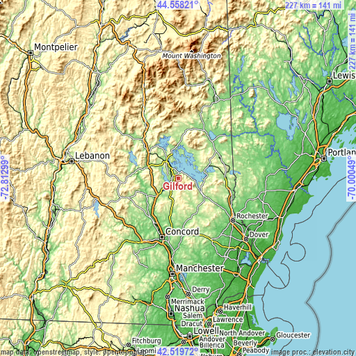
| \ | Map #1 | Map #2 | Topo.Map |
| Scale [m] | 151..724 m | 145..724 m | × |
| Scale [ft] | 495..2375 ft | 476..2375 ft | × |
| Average | 279.6 m = 917 ft | 254.1 m = 834 ft | × |
| Width | 7.08 km = 4.4 mi | 14.17 km = 8.8 mi | 226.7 km = 140.9 mi |
| Height | 7.08 km = 4.4 mi | 14.17 km = 8.8 mi | 226.6 km = 140.8 mi |
| ↑Max Latitude | 43.579423° | 43.61125° | 44.55821° |
| Latitude at center | 43.54758° | 43.54758° | 43.54758° |
| ↓Min Latitude | 43.51572° | 43.483843° | 42.51972° |
| ← Min Longitude | -71.450685° | -71.494631° | -72.81299° |
| Longitude center | -71.40674° | -71.40674° | -71.40674° |
| →Max Longitude | -71.362795° | -71.318849° | -70.00049° |
Nearby cities:
Cities around Gilford sort by population:
• Laconia elevation 152 m
5.6 km,  246°
246°
• Northfield 139 m
19.6 km,  229°
229°
• Tilton 141 m
18.8 km, 231°
• Gilmanton 304 m
13.7 km,  182°
182°
• Tilton-Northfield 137 m
19 km, 232°
• Wolfeboro 172 m
16.6 km,  75°
75°
• Sanbornton 245 m
15.6 km, 245°
• New Durham 165 m
22.6 km,  123°
123°
• Tuftonboro 306 m
22.3 km,  41°
41°
• Meredith 157 m
14.4 km,  328°
328°
• Belmont 174 m
12.7 km,  206°
206°
• Center Harbor 158 m
18.5 km,  346°
346°
Multilingual:
 En español:
Gilford elevación 228 m.
 En France:
Gilford élévation 228 m.


Sources and notes:
- [note 1] Map square and city borders are not equal. Map elevation data is calculated only from area inside that square.
- [src 1] Elevation data from geonames database provided with same terms of usage.
- [src 2] The elevation map of Gilford is generated using elevation data from NASA's 3 arcsec (90m) resolution SRTM data.
- [src 3] Base (background) map © OpenStreetMap contributors tiles are generated by Geofabrik and OpenTopoMap.
Copyright & License:
This Gilford Elevation Map is licensed under CC BY-SA. You may reuse any part from this page, if you give a proper credit by linking to this URL:
 More info on terms of use page.