Worthington elevation
Worthington (Minnesota, Nobles County), United States elevation is 486 meters and Worthington elevation in feet is 1594 ft above sea level [src 1]. Worthington is a seat of a second-order administrative division (feature code) with elevation that is 207 meters (679 ft) bigger than average city elevation in United States.
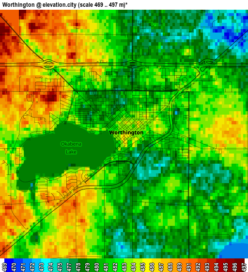
Below is the Elevation map of Worthington, which displays elevation range with different colors. Scale of the first map is from 469 to 497 m (1539 to 1631 ft) with average elevation of 482.2 meters (=1582 ft) [note 1]
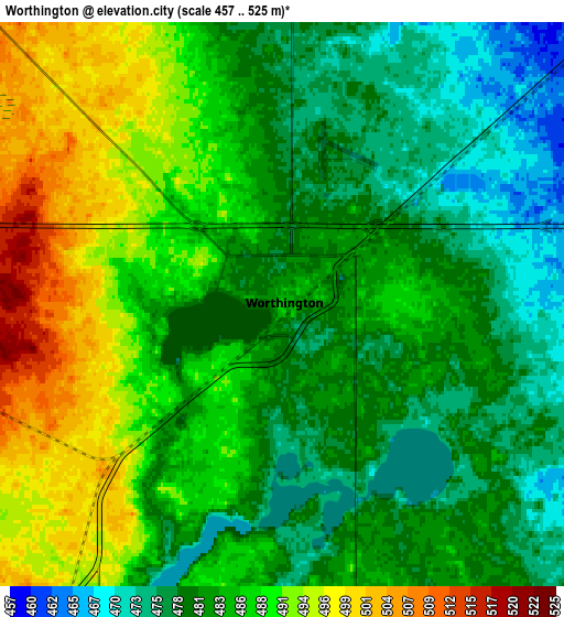
These maps also provides idea of topography and contour of this city, they are displayed at different zoom levels. More info about maps, scale and edge coordinates you can find below images.
| \ | Map #1 | Map #2 | Topo.Map |
| Scale [m] | 469..497 m | 457..525 m | × |
| Scale [ft] | 1539..1631 ft | 1499..1722 ft | × |
| Average | 482.2 m = 1582 ft | 484.3 m = 1589 ft | × |
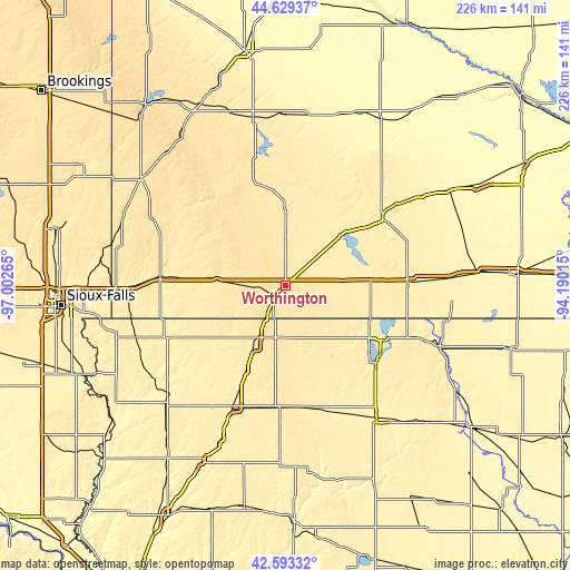
| Width | 7.07 km = 4.4 mi | 14.15 km = 8.8 mi | 226.4 km = 140.7 mi |
| Height | 7.07 km = 4.4 mi | 14.15 km = 8.8 mi | 226.4 km = 140.7 mi |
| ↑Max Latitude | 43.651765° | 43.683553° | 44.62937° |
| Latitude at center | 43.61996° | 43.61996° | 43.61996° |
| ↓Min Latitude | 43.588138° | 43.5563° | 42.59332° |
| ← Min Longitude | -95.640345° | -95.684291° | -97.00265° |
| Longitude center | -95.5964° | -95.5964° | -95.5964° |
| →Max Longitude | -95.552455° | -95.508509° | -94.19015° |
Nearby cities:
Cities around Worthington sort by population:
• Spirit Lake elevation 451 m
45.5 km,  118°
118°
• Windom 410 m
47.3 km,  54°
54°
• Jackson 396 m
48.9 km,  89°
89°
• Milford 437 m
48.7 km,  132°
132°
• Sibley 458 m
27.6 km,  207°
207°
• Slayton 494 m
42.8 km,  342°
342°
• Lakefield 451 m
34.8 km,  79°
79°
• Fulda 468 m
27.9 km,  359°
359°
• Arnolds Park 437 m
47 km, 125°
• Adrian 475 m
27.1 km,  273°
273°
• Lake Park 451 m
28.8 km, 129°
• George 417 m
44.9 km,  226°
226°
Multilingual:
 En español:
Worthington elevación 486 m.
 En France:
Worthington élévation 486 m.
 Auf Deutsch:
Worthington höhe über dem Meeresspiegel ist 486 m.

Sources and notes:
- [note 1] Map square and city borders are not equal. Map elevation data is calculated only from area inside that square.
- [src 1] Elevation data from geonames database provided with same terms of usage.
- [src 2] The elevation map of Worthington is generated using elevation data from NASA's 3 arcsec (90m) resolution SRTM data.
- [src 3] Base (background) map © OpenStreetMap contributors tiles are generated by Geofabrik and OpenTopoMap.
Copyright & License:
This Worthington Elevation Map is licensed under CC BY-SA. You may reuse any part from this page, if you give a proper credit by linking to this URL:
 More info on terms of use page.