Stillwater elevation
Stillwater (Minnesota, Washington County), United States elevation is 211 meters and Stillwater elevation in feet is 692 ft above sea level [src 1]. Stillwater is a seat of a second-order administrative division (feature code) with elevation that is 68 meters (223 ft) smaller than average city elevation in United States.
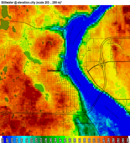
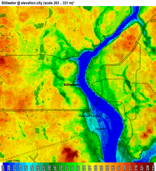
Below is the Elevation map of Stillwater, which displays elevation range with different colors. Scale of the first map is from 203 to 299 m (666 to 981 ft) with average elevation of 257.8 meters (=846 ft) [note 1]
These maps also provides idea of topography and contour of this city, they are displayed at different zoom levels. More info about maps, scale and edge coordinates you can find below images.
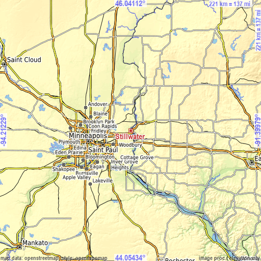
| \ | Map #1 | Map #2 | Topo.Map |
| Scale [m] | 203..299 m | 203..331 m | × |
| Scale [ft] | 666..981 ft | 666..1086 ft | × |
| Average | 257.8 m = 846 ft | 269.8 m = 885 ft | × |
| Width | 6.9 km = 4.3 mi | 13.81 km = 8.6 mi | 220.9 km = 137.3 mi |
| Height | 6.9 km = 4.3 mi | 13.81 km = 8.6 mi | 220.9 km = 137.3 mi |
| ↑Max Latitude | 45.087395° | 45.118413° | 46.04112° |
| Latitude at center | 45.05636° | 45.05636° | 45.05636° |
| ↓Min Latitude | 45.025308° | 44.994239° | 44.05434° |
| ← Min Longitude | -92.849985° | -92.893931° | -94.21229° |
| Longitude center | -92.80604° | -92.80604° | -92.80604° |
| →Max Longitude | -92.762095° | -92.718149° | -91.39979° |
Nearby cities:
Cities around Stillwater sort by population:
• Hudson elevation 218 m
9.9 km,  156°
156°
• Lake Elmo 279 m
8.9 km,  220°
220°
• Mahtomedi 305 m
11.5 km,  277°
277°
• Oak Park Heights 238 m
3 km, 159°
• Grant 305 m
8.8 km,  290°
290°
• North Hudson 225 m
8 km,  151°
151°
• Bayport 214 m
4.4 km, 153°
• Somerset 257 m
12.9 km,  53°
53°
• Lakeland 222 m
11.6 km, 164°
• Birchwood 296 m
13.4 km,  272°
272°
• Dellwood 288 m
13.6 km, 285°
• Lake Saint Croix Beach 211 m
15.4 km,  168°
168°
Multilingual:
 En español:
Stillwater elevación 211 m.
 En France:
Stillwater élévation 211 m.
 Auf Deutsch:
Stillwater höhe über dem Meeresspiegel ist 211 m.

Sources and notes:
- [note 1] Map square and city borders are not equal. Map elevation data is calculated only from area inside that square.
- [src 1] Elevation data from geonames database provided with same terms of usage.
- [src 2] The elevation map of Stillwater is generated using elevation data from NASA's 3 arcsec (90m) resolution SRTM data.
- [src 3] Base (background) map © OpenStreetMap contributors tiles are generated by Geofabrik and OpenTopoMap.
Copyright & License:
This Stillwater Elevation Map is licensed under CC BY-SA. You may reuse any part from this page, if you give a proper credit by linking to this URL:
 More info on terms of use page.