Bayport elevation
Bayport (Minnesota, Washington County), United States elevation is 214 meters and Bayport elevation in feet is 702 ft above sea level [src 1]. Bayport is a populated place (feature code) with elevation that is 65 meters (213 ft) smaller than average city elevation in United States.
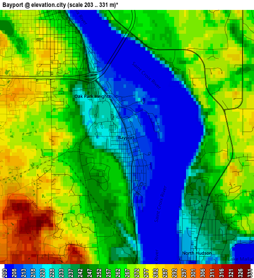
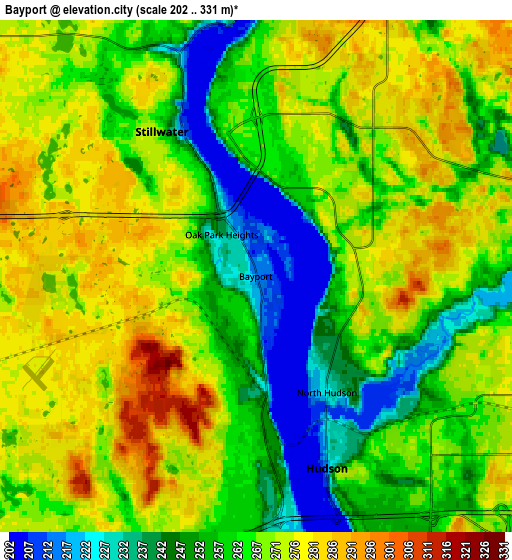
Below is the Elevation map of Bayport, which displays elevation range with different colors. Scale of the first map is from 203 to 331 m (666 to 1086 ft) with average elevation of 251.6 meters (=825 ft) [note 1]
These maps also provides idea of topography and contour of this city, they are displayed at different zoom levels. More info about maps, scale and edge coordinates you can find below images.
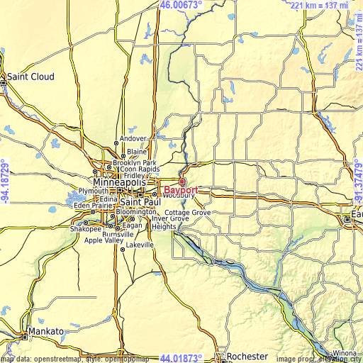
| \ | Map #1 | Map #2 | Topo.Map |
| Scale [m] | 203..331 m | 202..331 m | × |
| Scale [ft] | 666..1086 ft | 663..1086 ft | × |
| Average | 251.6 m = 825 ft | 264.2 m = 867 ft | × |
| Width | 6.91 km = 4.3 mi | 13.82 km = 8.6 mi | 221 km = 137.3 mi |
| Height | 6.91 km = 4.3 mi | 13.82 km = 8.6 mi | 221 km = 137.3 mi |
| ↑Max Latitude | 45.052414° | 45.083451° | 46.00673° |
| Latitude at center | 45.02136° | 45.02136° | 45.02136° |
| ↓Min Latitude | 44.990289° | 44.959201° | 44.01873° |
| ← Min Longitude | -92.824985° | -92.868931° | -94.18729° |
| Longitude center | -92.78104° | -92.78104° | -92.78104° |
| →Max Longitude | -92.737095° | -92.693149° | -91.37479° |
Nearby cities:
Cities around Bayport sort by population:
• Oakdale elevation 324 m
15.8 km,  245°
245°
• Stillwater 211 m
4.4 km,  333°
333°
• Hudson 218 m
5.5 km,  159°
159°
• Lake Elmo 279 m
8.2 km, 249°
• Mahtomedi 305 m
14.4 km,  291°
291°
• Oak Park Heights 238 m
1.5 km,  319°
319°
• Grant 305 m
12.4 km,  304°
304°
• North Hudson 225 m
3.7 km,  148°
148°
• Afton 215 m
13.2 km,  180°
180°
• Somerset 257 m
14.2 km,  36°
36°
• Lakeland 222 m
7.3 km,  170°
170°
• Lake Saint Croix Beach 211 m
11.2 km, 174°
Multilingual:
 En español:
Bayport elevación 214 m.
 En France:
Bayport élévation 214 m.


Sources and notes:
- [note 1] Map square and city borders are not equal. Map elevation data is calculated only from area inside that square.
- [src 1] Elevation data from geonames database provided with same terms of usage.
- [src 2] The elevation map of Bayport is generated using elevation data from NASA's 3 arcsec (90m) resolution SRTM data.
- [src 3] Base (background) map © OpenStreetMap contributors tiles are generated by Geofabrik and OpenTopoMap.
Copyright & License:
This Bayport Elevation Map is licensed under CC BY-SA. You may reuse any part from this page, if you give a proper credit by linking to this URL:
 More info on terms of use page.