Saint Cloud elevation
Saint Cloud (Minnesota, Stearns County), United States elevation is 318 meters and Saint Cloud elevation in feet is 1043 ft above sea level [src 1]. Saint Cloud is a seat of a second-order administrative division (feature code) with elevation that is 39 meters (128 ft) bigger than average city elevation in United States.
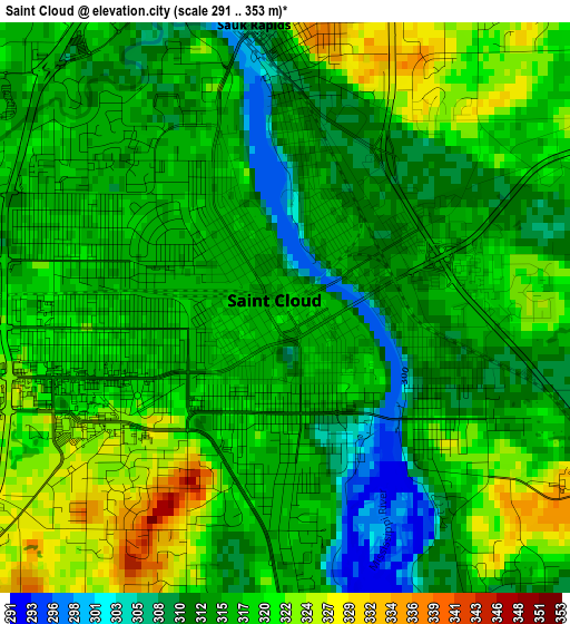
Below is the Elevation map of Saint Cloud, which displays elevation range with different colors. Scale of the first map is from 291 to 353 m (955 to 1158 ft) with average elevation of 316.6 meters (=1039 ft) [note 1]
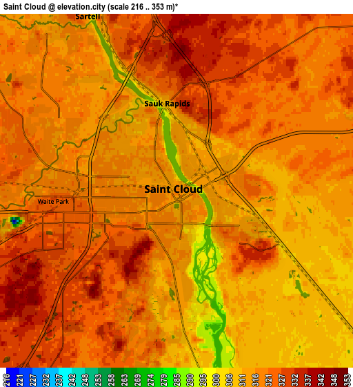
These maps also provides idea of topography and contour of this city, they are displayed at different zoom levels. More info about maps, scale and edge coordinates you can find below images.
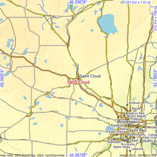
| \ | Map #1 | Map #2 | Topo.Map |
| Scale [m] | 291..353 m | 216..353 m | × |
| Scale [ft] | 955..1158 ft | 709..1158 ft | × |
| Average | 316.6 m = 1039 ft | 318.5 m = 1045 ft | × |
| Width | 6.84 km = 4.3 mi | 13.68 km = 8.5 mi | 219 km = 136.1 mi |
| Height | 6.84 km = 4.3 mi | 13.68 km = 8.5 mi | 218.9 km = 136 mi |
| ↑Max Latitude | 45.59156° | 45.622303° | 46.53676° |
| Latitude at center | 45.5608° | 45.5608° | 45.5608° |
| ↓Min Latitude | 45.530023° | 45.49923° | 44.56758° |
| ← Min Longitude | -94.206435° | -94.250381° | -95.56874° |
| Longitude center | -94.16249° | -94.16249° | -94.16249° |
| →Max Longitude | -94.118545° | -94.074599° | -92.75624° |
Nearby cities:
Cities around Saint Cloud sort by population:
• Sartell elevation 315 m
7.6 km,  332°
332°
• Sauk Rapids 314 m
3.5 km,  355°
355°
• Waite Park 327 m
4.8 km,  265°
265°
• Saint Joseph 334 m
12.1 km, 272°
• Collegeville 333 m
16 km,  283°
283°
• Saint Augusta 311 m
11.7 km,  193°
193°
• Saint Augusta 306 m
9.2 km,  175°
175°
• Foley 345 m
22.8 km,  59°
59°
• Rockville 329 m
17.1 km,  234°
234°
• Clearwater 295 m
18 km,  150°
150°
• Avon 344 m
23.1 km, 283°
• Rice 321 m
21.7 km,  348°
348°
Multilingual:
 En español:
Saint Cloud elevación 318 m.
 En France:
Saint Cloud élévation 318 m.
 Auf Deutsch:
Saint Cloud höhe über dem Meeresspiegel ist 318 m.

Sources and notes:
- [note 1] Map square and city borders are not equal. Map elevation data is calculated only from area inside that square.
- [src 1] Elevation data from geonames database provided with same terms of usage.
- [src 2] The elevation map of Saint Cloud is generated using elevation data from NASA's 3 arcsec (90m) resolution SRTM data.
- [src 3] Base (background) map © OpenStreetMap contributors tiles are generated by Geofabrik and OpenTopoMap.
Copyright & License:
This Saint Cloud Elevation Map is licensed under CC BY-SA. You may reuse any part from this page, if you give a proper credit by linking to this URL:
 More info on terms of use page.