Rochester elevation
Rochester (Minnesota, Olmsted County), United States elevation is 314 meters and Rochester elevation in feet is 1030 ft above sea level [src 1]. Rochester is a seat of a second-order administrative division (feature code) with elevation that is 35 meters (115 ft) bigger than average city elevation in United States.
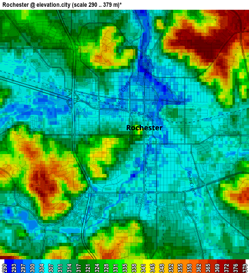
Below is the Elevation map of Rochester, which displays elevation range with different colors. Scale of the first map is from 290 to 379 m (951 to 1243 ft) with average elevation of 319.9 meters (=1050 ft) [note 1]
These maps also provides idea of topography and contour of this city, they are displayed at different zoom levels. More info about maps, scale and edge coordinates you can find below images.
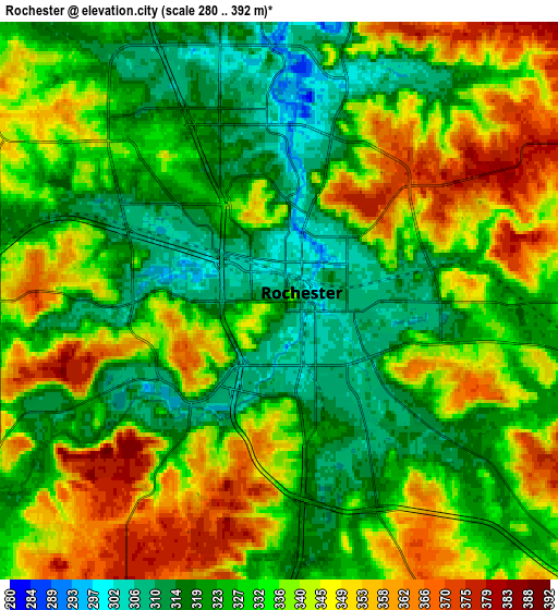
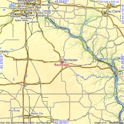
| \ | Map #1 | Map #2 | Topo.Map |
| Scale [m] | 290..379 m | 280..392 m | × |
| Scale [ft] | 951..1243 ft | 919..1286 ft | × |
| Average | 319.9 m = 1050 ft | 333.3 m = 1094 ft | × |
| Width | 7.03 km = 4.4 mi | 14.05 km = 8.7 mi | 224.9 km = 139.7 mi |
| Height | 7.03 km = 4.4 mi | 14.05 km = 8.7 mi | 224.9 km = 139.7 mi |
| ↑Max Latitude | 44.053222° | 44.084796° | 45.02421° |
| Latitude at center | 44.02163° | 44.02163° | 44.02163° |
| ↓Min Latitude | 43.990021° | 43.958396° | 43.00181° |
| ← Min Longitude | -92.513845° | -92.557791° | -93.87615° |
| Longitude center | -92.4699° | -92.4699° | -92.4699° |
| →Max Longitude | -92.425955° | -92.382009° | -91.06365° |
Nearby cities:
Cities around Rochester sort by population:
• Kasson elevation 383 m
22.5 km,  272°
272°
• Stewartville 374 m
18.5 km,  184°
184°
• Byron 384 m
14.1 km,  275°
275°
• Saint Charles 345 m
33 km,  100°
100°
• Pine Island 307 m
24.4 km,  324°
324°
• Plainview 355 m
28.7 km,  56°
56°
• Chatfield 308 m
29.8 km,  131°
131°
• Dodge Center 395 m
30.8 km, 271°
• Eyota 377 m
19.7 km, 100°
• Oronoco 296 m
16.9 km,  342°
342°
• Mantorville 359 m
23.4 km, 283°
• Elgin 326 m
21.2 km, 55°
Multilingual:
 En español:
Rochester elevación 314 m.
 En France:
Rochester élévation 314 m.
 Auf Deutsch:
Rochester höhe über dem Meeresspiegel ist 314 m.

Sources and notes:
- [note 1] Map square and city borders are not equal. Map elevation data is calculated only from area inside that square.
- [src 1] Elevation data from geonames database provided with same terms of usage.
- [src 2] The elevation map of Rochester is generated using elevation data from NASA's 3 arcsec (90m) resolution SRTM data.
- [src 3] Base (background) map © OpenStreetMap contributors tiles are generated by Geofabrik and OpenTopoMap.
Copyright & License:
This Rochester Elevation Map is licensed under CC BY-SA. You may reuse any part from this page, if you give a proper credit by linking to this URL:
 More info on terms of use page.