Otsego elevation
Otsego (Minnesota, Wright County), United States elevation is 267 meters and Otsego elevation in feet is 876 ft above sea level [src 1]. Otsego is a populated place (feature code) with elevation that is 12 meters (39 ft) smaller than average city elevation in United States.
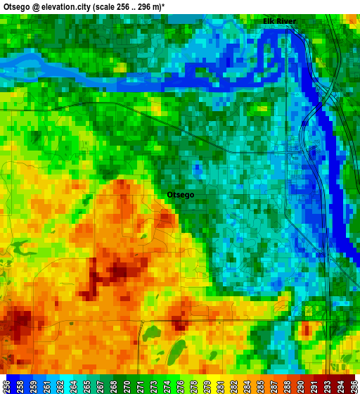
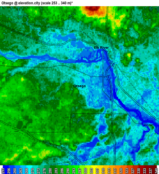
Below is the Elevation map of Otsego, which displays elevation range with different colors. Scale of the first map is from 256 to 296 m (840 to 971 ft) with average elevation of 272.6 meters (=894 ft) [note 1]
These maps also provides idea of topography and contour of this city, they are displayed at different zoom levels. More info about maps, scale and edge coordinates you can find below images.
| \ | Map #1 | Map #2 | Topo.Map |
| Scale [m] | 256..296 m | 253..340 m | × |
| Scale [ft] | 840..971 ft | 830..1115 ft | × |
| Average | 272.6 m = 894 ft | 277.5 m = 910 ft | × |
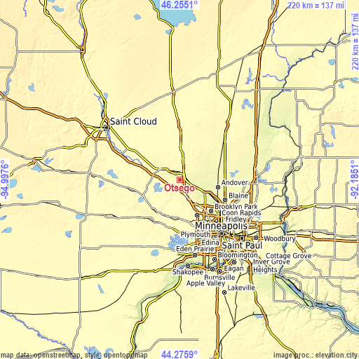
| Width | 6.88 km = 4.3 mi | 13.75 km = 8.5 mi | 220.1 km = 136.8 mi |
| Height | 6.88 km = 4.3 mi | 13.75 km = 8.5 mi | 220.1 km = 136.8 mi |
| ↑Max Latitude | 45.305047° | 45.335946° | 46.2551° |
| Latitude at center | 45.27413° | 45.27413° | 45.27413° |
| ↓Min Latitude | 45.243197° | 45.212246° | 44.2759° |
| ← Min Longitude | -93.635295° | -93.679241° | -94.9976° |
| Longitude center | -93.59135° | -93.59135° | -93.59135° |
| →Max Longitude | -93.547405° | -93.503459° | -92.1851° |
Nearby cities:
Cities around Otsego sort by population:
• Ramsey elevation 265 m
11.2 km,  97°
97°
• Elk River 270 m
3.8 km,  29°
29°
• Champlin 257 m
17.9 km,  121°
121°
• Anoka 266 m
18.1 km, 117°
• Saint Michael 293 m
9.2 km,  218°
218°
• Monticello 281 m
16.2 km,  282°
282°
• Rogers 289 m
9.9 km,  162°
162°
• Big Lake 286 m
13.7 km,  298°
298°
• Albertville 291 m
6.4 km,  230°
230°
• Dayton 264 m
6.9 km, 119°
• Nowthen 284 m
11.2 km,  57°
57°
• Hanover 278 m
14.4 km,  204°
204°
Multilingual:
 En español:
Otsego elevación 267 m.
 En France:
Otsego élévation 267 m.


Sources and notes:
- [note 1] Map square and city borders are not equal. Map elevation data is calculated only from area inside that square.
- [src 1] Elevation data from geonames database provided with same terms of usage.
- [src 2] The elevation map of Otsego is generated using elevation data from NASA's 3 arcsec (90m) resolution SRTM data.
- [src 3] Base (background) map © OpenStreetMap contributors tiles are generated by Geofabrik and OpenTopoMap.
Copyright & License:
This Otsego Elevation Map is licensed under CC BY-SA. You may reuse any part from this page, if you give a proper credit by linking to this URL:
 More info on terms of use page.