Independence elevation
Independence (Minnesota, Hennepin County), United States elevation is 297 meters and Independence elevation in feet is 974 ft above sea level [src 1]. Independence is a populated place (feature code) with elevation that is 18 meters (59 ft) bigger than average city elevation in United States.
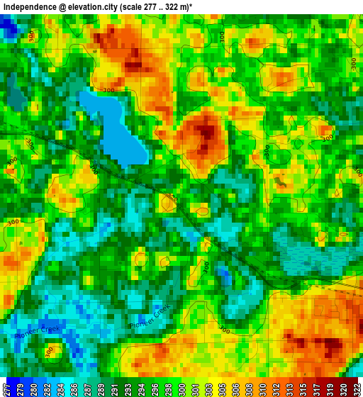
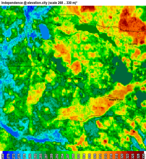
Below is the Elevation map of Independence, which displays elevation range with different colors. Scale of the first map is from 277 to 322 m (909 to 1056 ft) with average elevation of 297.1 meters (=975 ft) [note 1]
These maps also provides idea of topography and contour of this city, they are displayed at different zoom levels. More info about maps, scale and edge coordinates you can find below images.
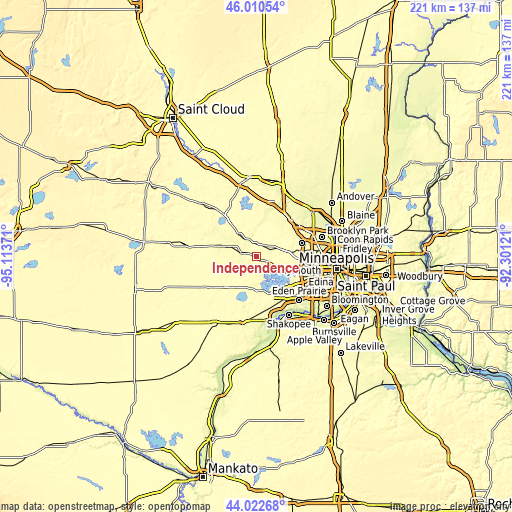
| \ | Map #1 | Map #2 | Topo.Map |
| Scale [m] | 277..322 m | 268..330 m | × |
| Scale [ft] | 909..1056 ft | 879..1083 ft | × |
| Average | 297.1 m = 975 ft | 295.3 m = 969 ft | × |
| Width | 6.91 km = 4.3 mi | 13.81 km = 8.6 mi | 221 km = 137.3 mi |
| Height | 6.91 km = 4.3 mi | 13.81 km = 8.6 mi | 221 km = 137.3 mi |
| ↑Max Latitude | 45.056292° | 45.087327° | 46.01054° |
| Latitude at center | 45.02524° | 45.02524° | 45.02524° |
| ↓Min Latitude | 44.994171° | 44.963086° | 44.02268° |
| ← Min Longitude | -93.751405° | -93.795351° | -95.11371° |
| Longitude center | -93.70746° | -93.70746° | -93.70746° |
| →Max Longitude | -93.663515° | -93.619569° | -92.30121° |
Nearby cities:
Cities around Independence sort by population:
• Mound elevation 285 m
10.4 km,  161°
161°
• Orono 296 m
10.1 km,  126°
126°
• Minnetrista 284 m
9.7 km,  184°
184°
• Medina 317 m
9.9 km,  83°
83°
• Delano 280 m
6.7 km,  286°
286°
• Rockford 275 m
7.3 km,  343°
343°
• Watertown 287 m
13 km,  238°
238°
• Greenfield 303 m
8.8 km,  8°
8°
• Saint Bonifacius 292 m
13.7 km,  193°
193°
• Long Lake 290 m
11.5 km,  111°
111°
• Maple Plain 310 m
4.5 km,  116°
116°
• Spring Park 289 m
11.6 km,  149°
149°
Multilingual:
 En español:
Independence elevación 297 m.
 En France:
Independence élévation 297 m.
 Auf Deutsch:
Independence höhe über dem Meeresspiegel ist 297 m.

Sources and notes:
- [note 1] Map square and city borders are not equal. Map elevation data is calculated only from area inside that square.
- [src 1] Elevation data from geonames database provided with same terms of usage.
- [src 2] The elevation map of Independence is generated using elevation data from NASA's 3 arcsec (90m) resolution SRTM data.
- [src 3] Base (background) map © OpenStreetMap contributors tiles are generated by Geofabrik and OpenTopoMap.
Copyright & License:
This Independence Elevation Map is licensed under CC BY-SA. You may reuse any part from this page, if you give a proper credit by linking to this URL:
 More info on terms of use page.