Delano elevation
Delano (Minnesota, Wright County), United States elevation is 280 meters and Delano elevation in feet is 919 ft above sea level [src 1]. Delano is a populated place (feature code) with elevation that is 1 meters (3 ft) bigger than average city elevation in United States.
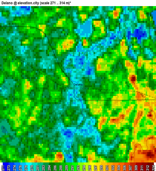
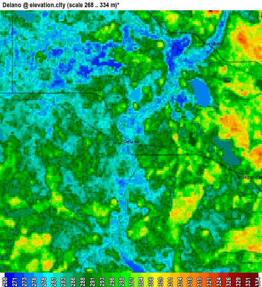
Below is the Elevation map of Delano, which displays elevation range with different colors. Scale of the first map is from 271 to 314 m (889 to 1030 ft) with average elevation of 287.2 meters (=942 ft) [note 1]
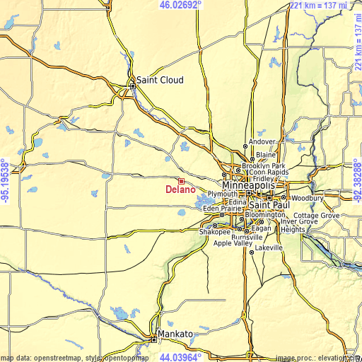
These maps also provides idea of topography and contour of this city, they are displayed at different zoom levels. More info about maps, scale and edge coordinates you can find below images.
| \ | Map #1 | Map #2 | Topo.Map |
| Scale [m] | 271..314 m | 268..334 m | × |
| Scale [ft] | 889..1030 ft | 879..1096 ft | × |
| Average | 287.2 m = 942 ft | 289.4 m = 949 ft | × |
| Width | 6.91 km = 4.3 mi | 13.81 km = 8.6 mi | 221 km = 137.3 mi |
| Height | 6.91 km = 4.3 mi | 13.81 km = 8.6 mi | 221 km = 137.3 mi |
| ↑Max Latitude | 45.072953° | 45.103979° | 46.02692° |
| Latitude at center | 45.04191° | 45.04191° | 45.04191° |
| ↓Min Latitude | 45.01085° | 44.979774° | 44.03964° |
| ← Min Longitude | -93.833075° | -93.877021° | -95.19538° |
| Longitude center | -93.78913° | -93.78913° | -93.78913° |
| →Max Longitude | -93.745185° | -93.701239° | -92.38288° |
Nearby cities:
Cities around Delano sort by population:
• Buffalo elevation 282 m
15.9 km,  335°
335°
• Mound 285 m
15.2 km,  140°
140°
• Minnetrista 284 m
12.8 km,  154°
154°
• Rockford 275 m
6.7 km,  39°
39°
• Watertown 287 m
9.8 km,  207°
207°
• Independence 297 m
6.7 km,  106°
106°
• Hanover 278 m
15.9 km, 37°
• Montrose 307 m
9.9 km,  284°
284°
• Greenfield 303 m
10.3 km,  48°
48°
• Saint Bonifacius 292 m
15.5 km,  167°
167°
• Maple Plain 310 m
11.2 km, 110°
• Waverly 307 m
14.2 km, 281°
Multilingual:
 En español:
Delano elevación 280 m.
 En France:
Delano élévation 280 m.


Sources and notes:
- [note 1] Map square and city borders are not equal. Map elevation data is calculated only from area inside that square.
- [src 1] Elevation data from geonames database provided with same terms of usage.
- [src 2] The elevation map of Delano is generated using elevation data from NASA's 3 arcsec (90m) resolution SRTM data.
- [src 3] Base (background) map © OpenStreetMap contributors tiles are generated by Geofabrik and OpenTopoMap.
Copyright & License:
This Delano Elevation Map is licensed under CC BY-SA. You may reuse any part from this page, if you give a proper credit by linking to this URL:
 More info on terms of use page.