Cambridge elevation
Cambridge (Minnesota, Isanti County), United States elevation is 291 meters and Cambridge elevation in feet is 955 ft above sea level [src 1]. Cambridge is a seat of a second-order administrative division (feature code) with elevation that is 12 meters (39 ft) bigger than average city elevation in United States.
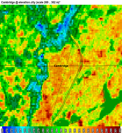
Below is the Elevation map of Cambridge, which displays elevation range with different colors. Scale of the first map is from 269 to 302 m (883 to 991 ft) with average elevation of 286.3 meters (=939 ft) [note 1]
These maps also provides idea of topography and contour of this city, they are displayed at different zoom levels. More info about maps, scale and edge coordinates you can find below images.
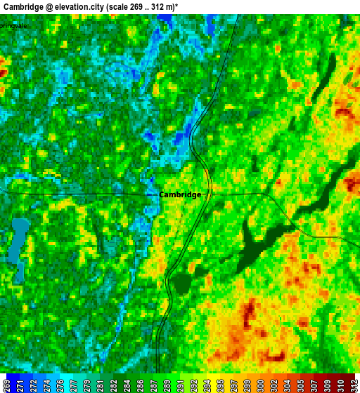
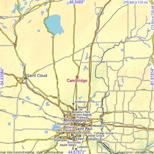
| \ | Map #1 | Map #2 | Topo.Map |
| Scale [m] | 269..302 m | 269..312 m | × |
| Scale [ft] | 883..991 ft | 883..1024 ft | × |
| Average | 286.3 m = 939 ft | 287 m = 942 ft | × |
| Width | 6.84 km = 4.3 mi | 13.68 km = 8.5 mi | 218.9 km = 136 mi |
| Height | 6.84 km = 4.3 mi | 13.68 km = 8.5 mi | 218.9 km = 136 mi |
| ↑Max Latitude | 45.603493° | 45.63423° | 46.5485° |
| Latitude at center | 45.57274° | 45.57274° | 45.57274° |
| ↓Min Latitude | 45.54197° | 45.511183° | 44.57973° |
| ← Min Longitude | -93.268335° | -93.312281° | -94.63064° |
| Longitude center | -93.22439° | -93.22439° | -93.22439° |
| →Max Longitude | -93.180445° | -93.136499° | -91.81814° |
Nearby cities:
Cities around Cambridge sort by population:
• East Bethel elevation 275 m
28.2 km,  176°
176°
• North Branch 271 m
20.2 km,  109°
109°
• Oak Grove 270 m
27 km,  197°
197°
• Saint Francis 279 m
23.2 km,  206°
206°
• Isanti 283 m
9.4 km,  191°
191°
• Princeton 299 m
27.8 km,  269°
269°
• Rush City 280 m
23.7 km,  58°
58°
• Branch 274 m
22.6 km,  115°
115°
• Braham 289 m
17.2 km,  14°
14°
• Rock Creek 284 m
28.9 km,  44°
44°
• Stacy 274 m
26.8 km,  136°
136°
• Harris 273 m
19.5 km,  85°
85°
Multilingual:
 En español:
Cambridge elevación 291 m.
 En France:
Cambridge élévation 291 m.
 Auf Deutsch:
Cambridge höhe über dem Meeresspiegel ist 291 m.
 На русском:
Кембридж, Кеймбридж высота над уровнем моря 291 м
Sources and notes:
- [note 1] Map square and city borders are not equal. Map elevation data is calculated only from area inside that square.
- [src 1] Elevation data from geonames database provided with same terms of usage.
- [src 2] The elevation map of Cambridge is generated using elevation data from NASA's 3 arcsec (90m) resolution SRTM data.
- [src 3] Base (background) map © OpenStreetMap contributors tiles are generated by Geofabrik and OpenTopoMap.
Copyright & License:
This Cambridge Elevation Map is licensed under CC BY-SA. You may reuse any part from this page, if you give a proper credit by linking to this URL:
 More info on terms of use page.