Appleton elevation
Appleton (Minnesota, Swift County), United States elevation is 310 meters and Appleton elevation in feet is 1017 ft above sea level [src 1]. Appleton is a populated place (feature code) with elevation that is 31 meters (102 ft) bigger than average city elevation in United States.
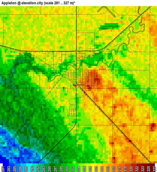
Below is the Elevation map of Appleton, which displays elevation range with different colors. Scale of the first map is from 281 to 327 m (922 to 1073 ft) with average elevation of 305.1 meters (=1001 ft) [note 1]
These maps also provides idea of topography and contour of this city, they are displayed at different zoom levels. More info about maps, scale and edge coordinates you can find below images.
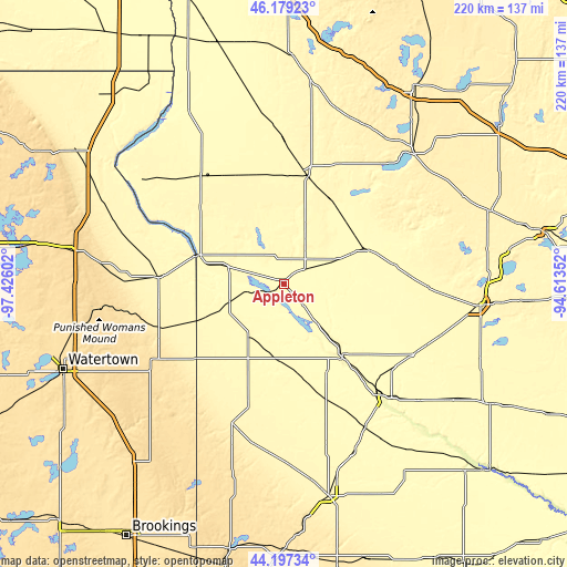
| \ | Map #1 | Topo.Map |
| Scale [m] | 281..327 m | × |
| Scale [ft] | 922..1073 ft | × |
| Average | 305.1 m = 1001 ft | × |
| Width | 6.89 km = 4.3 mi | 220.4 km = 136.9 mi |
| Height | 6.89 km = 4.3 mi | 220.4 km = 136.9 mi |
| ↑Max Latitude | 45.227869° | 46.17923° |
| Latitude at center | 45.19691° | 45.19691° |
| ↓Min Latitude | 45.165935° | 44.19734° |
| ← Min Longitude | -96.063715° | -97.42602° |
| Longitude center | -96.01977° | -96.01977° |
| →Max Longitude | -95.975825° | -94.61352° |
Nearby cities:
Cities around Appleton sort by population:
• Morris elevation 343 m
44.1 km,  10°
10°
• Montevideo 314 m
36.5 km,  139°
139°
• Milbank 351 m
48.3 km,  272°
272°
• Benson 318 m
35.4 km,  68°
68°
• Granite Falls 281 m
56.9 km, 139°
• Glenwood 352 m
70.4 km,  44°
44°
• Ortonville 309 m
35.4 km,  289°
289°
• Canby 377 m
57.9 km,  200°
200°
• Madison 332 m
25 km,  213°
213°
• Dawson 318 m
29.5 km,  185°
185°
• Clara City 321 m
57.9 km,  117°
117°
• Starbuck 355 m
60.1 km, 39°
Multilingual:
 En español:
Appleton elevación 310 m.
 En France:
Appleton élévation 310 m.
 Auf Deutsch:
Appleton höhe über dem Meeresspiegel ist 310 m.

Sources and notes:
- [note 1] Map square and city borders are not equal. Map elevation data is calculated only from area inside that square.
- [src 1] Elevation data from geonames database provided with same terms of usage.
- [src 2] The elevation map of Appleton is generated using elevation data from NASA's 3 arcsec (90m) resolution SRTM data.
- [src 3] Base (background) map © OpenStreetMap contributors tiles are generated by Geofabrik and OpenTopoMap.
Copyright & License:
This Appleton Elevation Map is licensed under CC BY-SA. You may reuse any part from this page, if you give a proper credit by linking to this URL:
 More info on terms of use page.