Troy elevation
Troy (Michigan, Oakland County), United States elevation is 231 meters and Troy elevation in feet is 758 ft above sea level [src 1]. Troy is a populated place (feature code) with elevation that is 48 meters (157 ft) smaller than average city elevation in United States.
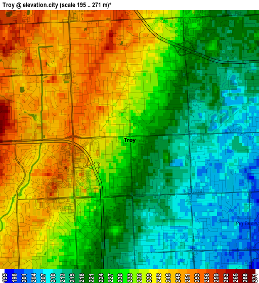
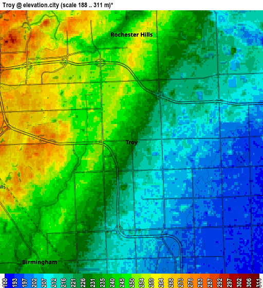
Below is the Elevation map of Troy, which displays elevation range with different colors. Scale of the first map is from 195 to 271 m (640 to 889 ft) with average elevation of 230 meters (=755 ft) [note 1]
These maps also provides idea of topography and contour of this city, they are displayed at different zoom levels. More info about maps, scale and edge coordinates you can find below images.
| \ | Map #1 | Map #2 | Topo.Map |
| Scale [m] | 195..271 m | 188..311 m | × |
| Scale [ft] | 640..889 ft | 617..1020 ft | × |
| Average | 230 m = 755 ft | 230.3 m = 756 ft | × |
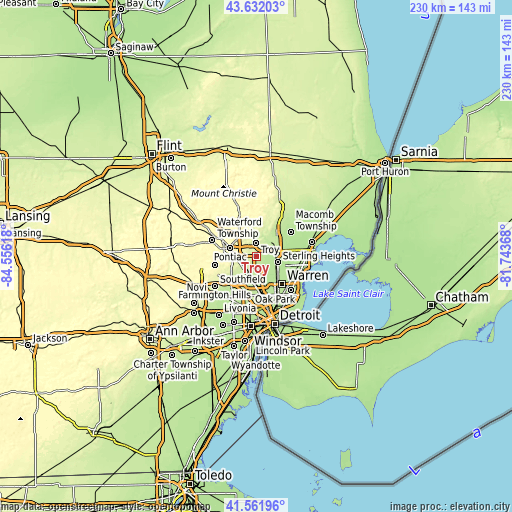
| Width | 7.19 km = 4.5 mi | 14.39 km = 8.9 mi | 230.2 km = 143 mi |
| Height | 7.19 km = 4.5 mi | 14.39 km = 8.9 mi | 230.2 km = 143 mi |
| ↑Max Latitude | 42.637927° | 42.670247° | 43.63203° |
| Latitude at center | 42.60559° | 42.60559° | 42.60559° |
| ↓Min Latitude | 42.573236° | 42.540866° | 41.56196° |
| ← Min Longitude | -83.193875° | -83.237821° | -84.55618° |
| Longitude center | -83.14993° | -83.14993° | -83.14993° |
| →Max Longitude | -83.105985° | -83.062039° | -81.74368° |
Nearby cities:
Cities around Troy sort by population:
• Sterling Heights elevation 190 m
10.2 km,  106°
106°
• Shelby 210 m
12 km,  52°
52°
• Rochester Hills 250 m
5.9 km,  0°
0°
• Pontiac 289 m
12.1 km,  287°
287°
• Auburn Hills 293 m
11.4 km,  322°
322°
• Birmingham 241 m
8.3 km,  217°
217°
• Berkley 209 m
11.7 km,  193°
193°
• Rochester 232 m
8.4 km,  8°
8°
• Clawson 203 m
8 km,  177°
177°
• Beverly Hills 227 m
10.9 km,  213°
213°
• Utica 199 m
9.8 km,  76°
76°
• Bloomfield Hills 256 m
8.2 km,  252°
252°
Multilingual:
 En español:
Troy elevación 231 m.
 En France:
Troy élévation 231 m.


Sources and notes:
- [note 1] Map square and city borders are not equal. Map elevation data is calculated only from area inside that square.
- [src 1] Elevation data from geonames database provided with same terms of usage.
- [src 2] The elevation map of Troy is generated using elevation data from NASA's 3 arcsec (90m) resolution SRTM data.
- [src 3] Base (background) map © OpenStreetMap contributors tiles are generated by Geofabrik and OpenTopoMap.
Copyright & License:
This Troy Elevation Map is licensed under CC BY-SA. You may reuse any part from this page, if you give a proper credit by linking to this URL:
 More info on terms of use page.