Pontiac elevation
Pontiac (Michigan, Oakland County), United States elevation is 289 meters and Pontiac elevation in feet is 948 ft above sea level [src 1]. Pontiac is a seat of a second-order administrative division (feature code) with elevation that is 10 meters (33 ft) bigger than average city elevation in United States.
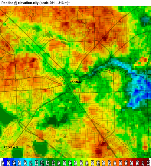
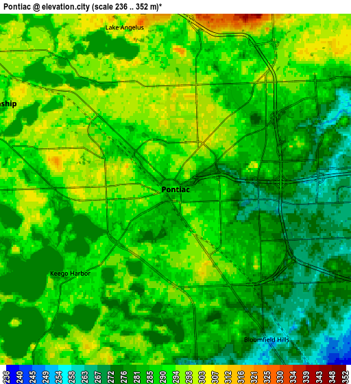
Below is the Elevation map of Pontiac, which displays elevation range with different colors. Scale of the first map is from 261 to 313 m (856 to 1027 ft) with average elevation of 290.3 meters (=952 ft) [note 1]
These maps also provides idea of topography and contour of this city, they are displayed at different zoom levels. More info about maps, scale and edge coordinates you can find below images.
| \ | Map #1 | Map #2 | Topo.Map |
| Scale [m] | 261..313 m | 236..352 m | × |
| Scale [ft] | 856..1027 ft | 774..1155 ft | × |
| Average | 290.3 m = 952 ft | 287.4 m = 943 ft | × |
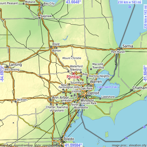
| Width | 7.19 km = 4.5 mi | 14.38 km = 8.9 mi | 230 km = 142.9 mi |
| Height | 7.19 km = 4.5 mi | 14.38 km = 8.9 mi | 230 km = 142.9 mi |
| ↑Max Latitude | 42.671239° | 42.703542° | 43.6648° |
| Latitude at center | 42.63892° | 42.63892° | 42.63892° |
| ↓Min Latitude | 42.606584° | 42.574231° | 41.59584° |
| ← Min Longitude | -83.334995° | -83.378941° | -84.6973° |
| Longitude center | -83.29105° | -83.29105° | -83.29105° |
| →Max Longitude | -83.247105° | -83.203159° | -81.8848° |
Nearby cities:
Cities around Pontiac sort by population:
• Troy elevation 231 m
12.1 km,  107°
107°
• Waterford 302 m
11.6 km,  301°
301°
• Rochester Hills 250 m
11.7 km,  79°
79°
• West Bloomfield Township 303 m
10.9 km,  224°
224°
• Auburn Hills 293 m
7.1 km,  40°
40°
• Birmingham 241 m
12.2 km,  147°
147°
• Rochester 232 m
13.7 km,  70°
70°
• Bloomfield Hills 256 m
7.2 km, 148°
• Franklin 257 m
13 km,  185°
185°
• Keego Harbor 285 m
5.5 km,  231°
231°
• Orchard Lake 291 m
8.4 km, 222°
• Sylvan Lake 293 m
4.3 km, 225°
Multilingual:
 En español:
Pontiac elevación 289 m.
 En France:
Pontiac élévation 289 m.


Sources and notes:
- [note 1] Map square and city borders are not equal. Map elevation data is calculated only from area inside that square.
- [src 1] Elevation data from geonames database provided with same terms of usage.
- [src 2] The elevation map of Pontiac is generated using elevation data from NASA's 3 arcsec (90m) resolution SRTM data.
- [src 3] Base (background) map © OpenStreetMap contributors tiles are generated by Geofabrik and OpenTopoMap.
Copyright & License:
This Pontiac Elevation Map is licensed under CC BY-SA. You may reuse any part from this page, if you give a proper credit by linking to this URL:
 More info on terms of use page.