Milford elevation
Milford (Michigan, Oakland County), United States elevation is 297 meters and Milford elevation in feet is 974 ft above sea level [src 1]. Milford is a populated place (feature code) with elevation that is 18 meters (59 ft) bigger than average city elevation in United States.
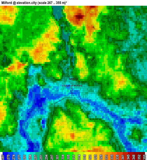
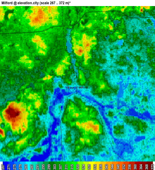
Below is the Elevation map of Milford, which displays elevation range with different colors. Scale of the first map is from 267 to 355 m (876 to 1165 ft) with average elevation of 299.7 meters (=983 ft) [note 1]
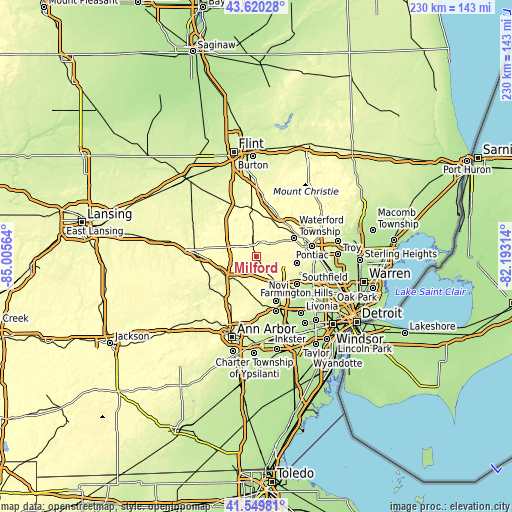
These maps also provides idea of topography and contour of this city, they are displayed at different zoom levels. More info about maps, scale and edge coordinates you can find below images.
| \ | Map #1 | Map #2 | Topo.Map |
| Scale [m] | 267..355 m | 267..372 m | × |
| Scale [ft] | 876..1165 ft | 876..1220 ft | × |
| Average | 299.7 m = 983 ft | 301.2 m = 988 ft | × |
| Width | 7.19 km = 4.5 mi | 14.39 km = 8.9 mi | 230.2 km = 143 mi |
| Height | 7.19 km = 4.5 mi | 14.39 km = 8.9 mi | 230.2 km = 143 mi |
| ↑Max Latitude | 42.625983° | 42.658309° | 43.62028° |
| Latitude at center | 42.59364° | 42.59364° | 42.59364° |
| ↓Min Latitude | 42.56128° | 42.528904° | 41.54981° |
| ← Min Longitude | -83.643335° | -83.687281° | -85.00564° |
| Longitude center | -83.59939° | -83.59939° | -83.59939° |
| →Max Longitude | -83.555445° | -83.511499° | -82.19314° |
Nearby cities:
Cities around Milford sort by population:
• Waterford elevation 302 m
18.9 km,  54°
54°
• West Bloomfield Township 303 m
17.9 km,  98°
98°
• Novi 276 m
16.2 km,  141°
141°
• Wixom 285 m
9.2 km,  146°
146°
• South Lyon 282 m
15.4 km,  196°
196°
• Brighton 283 m
16.4 km,  244°
244°
• Walled Lake 288 m
11.5 km,  122°
122°
• Whitmore Lake 286 m
20.9 km,  214°
214°
• Northville 255 m
20.4 km, 152°
• Wolverine Lake 285 m
11.1 km,  111°
111°
• Keego Harbor 285 m
21 km,  85°
85°
• Orchard Lake 291 m
19.7 km, 93°
Multilingual:
 En español:
Milford elevación 297 m.
 En France:
Milford élévation 297 m.


Sources and notes:
- [note 1] Map square and city borders are not equal. Map elevation data is calculated only from area inside that square.
- [src 1] Elevation data from geonames database provided with same terms of usage.
- [src 2] The elevation map of Milford is generated using elevation data from NASA's 3 arcsec (90m) resolution SRTM data.
- [src 3] Base (background) map © OpenStreetMap contributors tiles are generated by Geofabrik and OpenTopoMap.
Copyright & License:
This Milford Elevation Map is licensed under CC BY-SA. You may reuse any part from this page, if you give a proper credit by linking to this URL:
 More info on terms of use page.