Kilmanagh elevation
Kilmanagh (Michigan, Huron County), United States elevation is 191 meters and Kilmanagh elevation in feet is 627 ft above sea level [src 1]. Kilmanagh is a populated place (feature code) with elevation that is 88 meters (289 ft) smaller than average city elevation in United States.
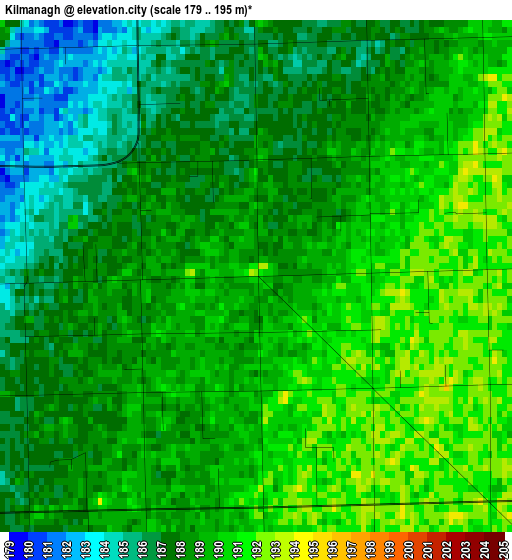
Below is the Elevation map of Kilmanagh, which displays elevation range with different colors. Scale of the first map is from 179 to 195 m (587 to 640 ft) with average elevation of 188.3 meters (=618 ft) [note 1]
These maps also provides idea of topography and contour of this city, they are displayed at different zoom levels. More info about maps, scale and edge coordinates you can find below images.
| \ | Map #1 | Topo.Map |
| Scale [m] | 179..195 m | × |
| Scale [ft] | 587..640 ft | × |
| Average | 188.3 m = 618 ft | × |
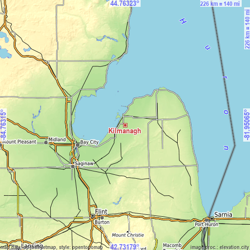
| Width | 7.06 km = 4.4 mi | 225.9 km = 140.4 mi |
| Height | 7.06 km = 4.4 mi | 225.9 km = 140.4 mi |
| ↑Max Latitude | 43.787863° | 44.76323° |
| Latitude at center | 43.75613° | 43.75613° |
| ↓Min Latitude | 43.72438° | 42.73179° |
| ← Min Longitude | -83.400845° | -84.76315° |
| Longitude center | -83.3569° | -83.3569° |
| →Max Longitude | -83.312955° | -81.95065° |
Nearby cities:
Cities around Kilmanagh sort by population:
• Bay City elevation 179 m
46.4 km,  247°
247°
• Caro 222 m
29.7 km,  186°
186°
• Essexville 178 m
42 km, 248°
• Bad Axe 230 m
29 km,  79°
79°
• Vassar 196 m
46.4 km,  203°
203°
• Cass City 227 m
22.6 km,  139°
139°
• Marlette 255 m
52.7 km,  154°
154°
• Sebewaing 180 m
8 km, 250°
• Standish 188 m
54.5 km,  297°
297°
• Reese 192 m
43.6 km,  218°
218°
• Pinconning 181 m
50 km,  282°
282°
• Pigeon 191 m
10.8 km,  40°
40°
Multilingual:
 En español:
Kilmanagh elevación 191 m.
 En France:
Kilmanagh élévation 191 m.
 Auf Deutsch:
Kilmanagh höhe über dem Meeresspiegel ist 191 m.

Sources and notes:
- [note 1] Map square and city borders are not equal. Map elevation data is calculated only from area inside that square.
- [src 1] Elevation data from geonames database provided with same terms of usage.
- [src 2] The elevation map of Kilmanagh is generated using elevation data from NASA's 3 arcsec (90m) resolution SRTM data.
- [src 3] Base (background) map © OpenStreetMap contributors tiles are generated by Geofabrik and OpenTopoMap.
Copyright & License:
This Kilmanagh Elevation Map is licensed under CC BY-SA. You may reuse any part from this page, if you give a proper credit by linking to this URL:
 More info on terms of use page.