Iron Mountain elevation
Iron Mountain (Michigan, Dickinson County), United States elevation is 344 meters and Iron Mountain elevation in feet is 1129 ft above sea level [src 1]. Iron Mountain is a seat of a second-order administrative division (feature code) with elevation that is 65 meters (213 ft) bigger than average city elevation in United States.
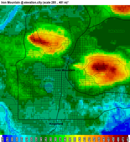
Below is the Elevation map of Iron Mountain, which displays elevation range with different colors. Scale of the first map is from 285 to 481 m (935 to 1578 ft) with average elevation of 355.5 meters (=1166 ft) [note 1]
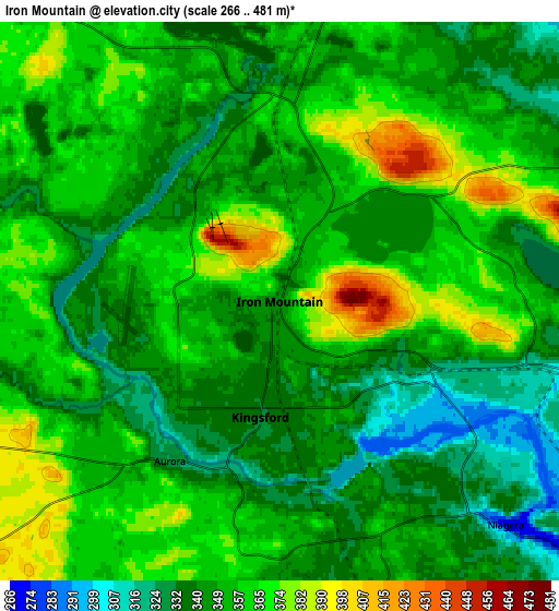
These maps also provides idea of topography and contour of this city, they are displayed at different zoom levels. More info about maps, scale and edge coordinates you can find below images.
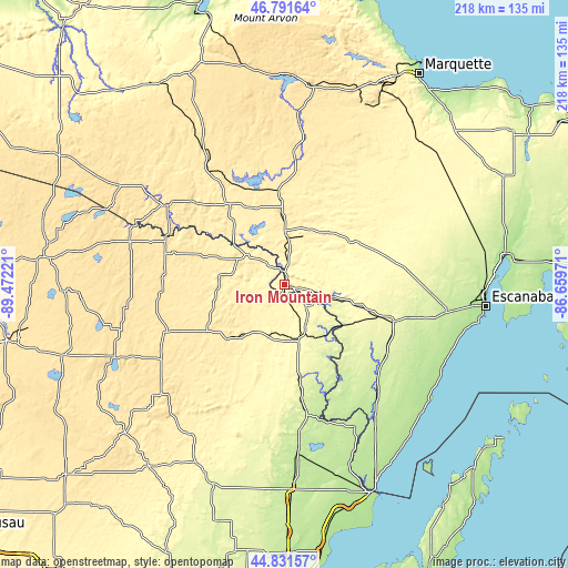
| \ | Map #1 | Map #2 | Topo.Map |
| Scale [m] | 285..481 m | 266..481 m | × |
| Scale [ft] | 935..1578 ft | 873..1578 ft | × |
| Average | 355.5 m = 1166 ft | 351.9 m = 1155 ft | × |
| Width | 6.81 km = 4.2 mi | 13.62 km = 8.5 mi | 217.9 km = 135.4 mi |
| Height | 6.81 km = 4.2 mi | 13.62 km = 8.5 mi | 217.9 km = 135.4 mi |
| ↑Max Latitude | 45.850848° | 45.881448° | 46.79164° |
| Latitude at center | 45.82023° | 45.82023° | 45.82023° |
| ↓Min Latitude | 45.789596° | 45.758944° | 44.83157° |
| ← Min Longitude | -88.109905° | -88.153851° | -89.47221° |
| Longitude center | -88.06596° | -88.06596° | -88.06596° |
| →Max Longitude | -88.022015° | -87.978069° | -86.65971° |
Nearby cities:
Cities around Iron Mountain sort by population:
• Escanaba elevation 181 m
78.1 km,  96°
96°
• Kingsford 332 m
2.8 km,  189°
189°
• Iron River 458 m
53.9 km,  304°
304°
• Norway 291 m
13.1 km,  106°
106°
• K. I. Sawyer Air Force Base 362 m
78.6 km,  41°
41°
• Gwinn 331 m
70.4 km, 43°
• Crandon 497 m
70.6 km,  246°
246°
• Niagara 268 m
7.7 km,  134°
134°
• Crystal Falls 448 m
37.2 km,  326°
326°
• Stambaugh, Iron River 497 m
52.2 km, 303°
• Quinnesec 316 m
6.2 km, 104°
• Florence 391 m
18.3 km,  308°
308°
Multilingual:
 En español:
Iron Mountain elevación 344 m.
 En France:
Iron Mountain élévation 344 m.
 Auf Deutsch:
Iron Mountain höhe über dem Meeresspiegel ist 344 m.

Sources and notes:
- [note 1] Map square and city borders are not equal. Map elevation data is calculated only from area inside that square.
- [src 1] Elevation data from geonames database provided with same terms of usage.
- [src 2] The elevation map of Iron Mountain is generated using elevation data from NASA's 3 arcsec (90m) resolution SRTM data.
- [src 3] Base (background) map © OpenStreetMap contributors tiles are generated by Geofabrik and OpenTopoMap.
Copyright & License:
This Iron Mountain Elevation Map is licensed under CC BY-SA. You may reuse any part from this page, if you give a proper credit by linking to this URL:
 More info on terms of use page.