Capac elevation
Capac (Michigan, Saint Clair County), United States elevation is 247 meters and Capac elevation in feet is 810 ft above sea level [src 1]. Capac is a populated place (feature code) with elevation that is 32 meters (105 ft) smaller than average city elevation in United States.
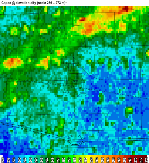
Below is the Elevation map of Capac, which displays elevation range with different colors. Scale of the first map is from 236 to 273 m (774 to 896 ft) with average elevation of 245.9 meters (=807 ft) [note 1]
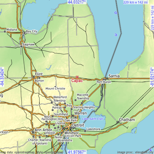
These maps also provides idea of topography and contour of this city, they are displayed at different zoom levels. More info about maps, scale and edge coordinates you can find below images.
| \ | Map #1 | Topo.Map |
| Scale [m] | 236..273 m | × |
| Scale [ft] | 774..896 ft | × |
| Average | 245.9 m = 807 ft | × |
| Width | 7.15 km = 4.4 mi | 228.7 km = 142.1 mi |
| Height | 7.15 km = 4.4 mi | 228.7 km = 142.1 mi |
| ↑Max Latitude | 43.044655° | 44.03217° |
| Latitude at center | 43.01253° | 43.01253° |
| ↓Min Latitude | 42.980389° | 41.97567° |
| ← Min Longitude | -82.971935° | -84.33424° |
| Longitude center | -82.92799° | -82.92799° |
| →Max Longitude | -82.884045° | -81.52174° |
Nearby cities:
Cities around Capac sort by population:
• Lapeer elevation 266 m
32.1 km,  277°
277°
• Richmond 223 m
26.6 km,  148°
148°
• New Haven 192 m
33.1 km,  161°
161°
• Romeo 247 m
24.3 km,  196°
196°
• Imlay City 252 m
12.2 km, 276°
• Oxford 324 m
34.5 km,  232°
232°
• Almont 261 m
14 km,  222°
222°
• Yale 241 m
16.8 km,  38°
38°
• Armada 230 m
19.1 km,  169°
169°
• Brown City 252 m
22.8 km,  347°
347°
• Memphis 231 m
18.3 km,  134°
134°
• North Branch 248 m
32.5 km,  317°
317°
Multilingual:
 En español:
Capac elevación 247 m.
 En France:
Capac élévation 247 m.


Sources and notes:
- [note 1] Map square and city borders are not equal. Map elevation data is calculated only from area inside that square.
- [src 1] Elevation data from geonames database provided with same terms of usage.
- [src 2] The elevation map of Capac is generated using elevation data from NASA's 3 arcsec (90m) resolution SRTM data.
- [src 3] Base (background) map © OpenStreetMap contributors tiles are generated by Geofabrik and OpenTopoMap.
Copyright & License:
This Capac Elevation Map is licensed under CC BY-SA. You may reuse any part from this page, if you give a proper credit by linking to this URL:
 More info on terms of use page.