Almont elevation
Almont (Michigan, Lapeer County), United States elevation is 261 meters and Almont elevation in feet is 856 ft above sea level [src 1]. Almont is a populated place (feature code) with elevation that is 18 meters (59 ft) smaller than average city elevation in United States.
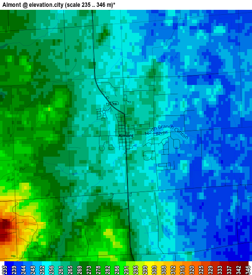
Below is the Elevation map of Almont, which displays elevation range with different colors. Scale of the first map is from 235 to 346 m (771 to 1135 ft) with average elevation of 260.4 meters (=854 ft) [note 1]
These maps also provides idea of topography and contour of this city, they are displayed at different zoom levels. More info about maps, scale and edge coordinates you can find below images.
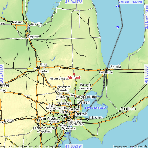
| \ | Map #1 | Topo.Map |
| Scale [m] | 235..346 m | × |
| Scale [ft] | 771..1135 ft | × |
| Average | 260.4 m = 854 ft | × |
| Width | 7.16 km = 4.4 mi | 229 km = 142.3 mi |
| Height | 7.16 km = 4.4 mi | 229 km = 142.3 mi |
| ↑Max Latitude | 42.952753° | 43.94176° |
| Latitude at center | 42.92058° | 42.92058° |
| ↓Min Latitude | 42.888391° | 41.88219° |
| ← Min Longitude | -83.088875° | -84.45118° |
| Longitude center | -83.04493° | -83.04493° |
| →Max Longitude | -83.000985° | -81.63868° |
Nearby cities:
Cities around Almont sort by population:
• Shelby elevation 210 m
27.8 km,  177°
177°
• Rochester 232 m
27.7 km,  195°
195°
• Lapeer 266 m
26.6 km,  303°
303°
• Richmond 223 m
26.6 km,  117°
117°
• New Haven 192 m
29.1 km,  136°
136°
• Romeo 247 m
13.4 km,  168°
168°
• Imlay City 252 m
11.9 km,  347°
347°
• Oxford 324 m
20.8 km,  239°
239°
• Lake Orion 301 m
21.9 km,  226°
226°
• Capac 247 m
14 km,  42°
42°
• Armada 230 m
15.6 km, 122°
• Memphis 231 m
22.6 km,  96°
96°
Multilingual:
 En español:
Almont elevación 261 m.
 En France:
Almont élévation 261 m.


Sources and notes:
- [note 1] Map square and city borders are not equal. Map elevation data is calculated only from area inside that square.
- [src 1] Elevation data from geonames database provided with same terms of usage.
- [src 2] The elevation map of Almont is generated using elevation data from NASA's 3 arcsec (90m) resolution SRTM data.
- [src 3] Base (background) map © OpenStreetMap contributors tiles are generated by Geofabrik and OpenTopoMap.
Copyright & License:
This Almont Elevation Map is licensed under CC BY-SA. You may reuse any part from this page, if you give a proper credit by linking to this URL:
 More info on terms of use page.