Palmer elevation
Palmer (Massachusetts, Hampden County), United States elevation is 109 meters and Palmer elevation in feet is 358 ft above sea level [src 1]. Palmer is a populated place (feature code) with elevation that is 170 meters (558 ft) smaller than average city elevation in United States.
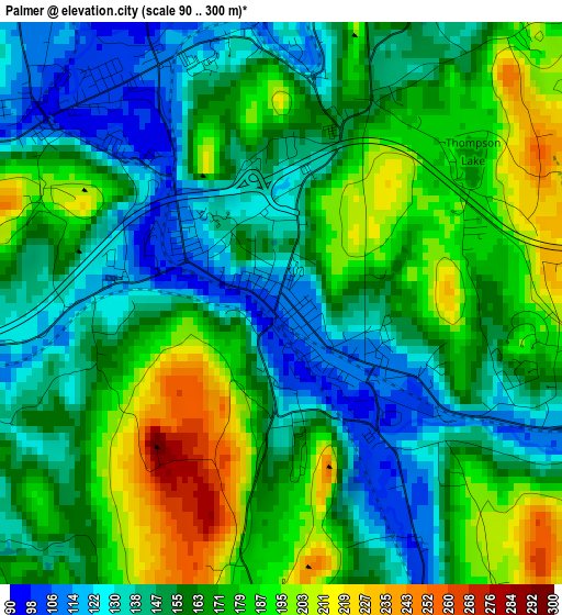
Below is the Elevation map of Palmer, which displays elevation range with different colors. Scale of the first map is from 90 to 300 m (295 to 984 ft) with average elevation of 162.6 meters (=533 ft) [note 1]
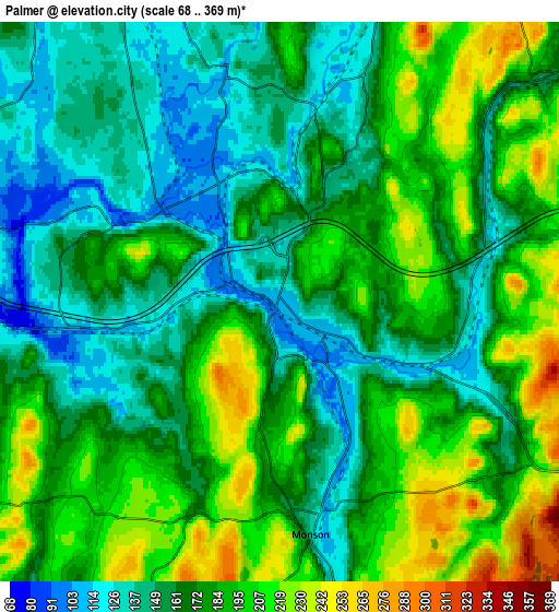
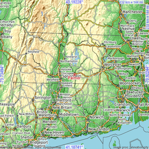
These maps also provides idea of topography and contour of this city, they are displayed at different zoom levels. More info about maps, scale and edge coordinates you can find below images.
| \ | Map #1 | Map #2 | Topo.Map |
| Scale [m] | 90..300 m | 68..369 m | × |
| Scale [ft] | 295..984 ft | 223..1211 ft | × |
| Average | 162.6 m = 533 ft | 174.7 m = 573 ft | × |
| Width | 7.24 km = 4.5 mi | 14.49 km = 9 mi | 231.8 km = 144 mi |
| Height | 7.24 km = 4.5 mi | 14.49 km = 9 mi | 231.8 km = 144 mi |
| ↑Max Latitude | 42.190998° | 42.223549° | 43.19228° |
| Latitude at center | 42.15843° | 42.15843° | 42.15843° |
| ↓Min Latitude | 42.125845° | 42.093244° | 41.10741° |
| ← Min Longitude | -72.372635° | -72.416581° | -73.73494° |
| Longitude center | -72.32869° | -72.32869° | -72.32869° |
| →Max Longitude | -72.284745° | -72.240799° | -70.92244° |
Nearby cities:
Cities around Palmer sort by population:
• Ludlow elevation 77 m
12.1 km,  270°
270°
• Monson 138 m
6.1 km,  172°
172°
• Ware 132 m
13.4 km,  33°
33°
• Hampden 100 m
12.6 km,  213°
213°
• Wilbraham 89 m
9.3 km,  245°
245°
• Brimfield 207 m
11.3 km,  110°
110°
• Belchertown 187 m
14.5 km,  335°
335°
• Three Rivers 99 m
3.7 km,  313°
313°
• Monson Center 174 m
6.9 km,  163°
163°
• Bondsville 118 m
6.2 km,  347°
347°
• Wales 294 m
13.2 km,  138°
138°
• Warren 200 m
12.8 km,  62°
62°
Multilingual:
 En español:
Palmer elevación 109 m.
 En France:
Palmer élévation 109 m.


Sources and notes:
- [note 1] Map square and city borders are not equal. Map elevation data is calculated only from area inside that square.
- [src 1] Elevation data from geonames database provided with same terms of usage.
- [src 2] The elevation map of Palmer is generated using elevation data from NASA's 3 arcsec (90m) resolution SRTM data.
- [src 3] Base (background) map © OpenStreetMap contributors tiles are generated by Geofabrik and OpenTopoMap.
Copyright & License:
This Palmer Elevation Map is licensed under CC BY-SA. You may reuse any part from this page, if you give a proper credit by linking to this URL:
 More info on terms of use page.