Bondsville elevation
Bondsville (Massachusetts, Hampden County), United States elevation is 118 meters and Bondsville elevation in feet is 387 ft above sea level [src 1]. Bondsville is a populated place (feature code) with elevation that is 161 meters (528 ft) smaller than average city elevation in United States.
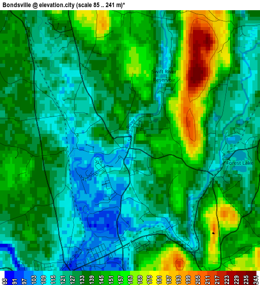
Below is the Elevation map of Bondsville, which displays elevation range with different colors. Scale of the first map is from 85 to 241 m (279 to 791 ft) with average elevation of 135.5 meters (=445 ft) [note 1]
These maps also provides idea of topography and contour of this city, they are displayed at different zoom levels. More info about maps, scale and edge coordinates you can find below images.
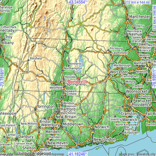
| \ | Map #1 | Topo.Map |
| Scale [m] | 85..241 m | × |
| Scale [ft] | 279..791 ft | × |
| Average | 135.5 m = 445 ft | × |
| Width | 7.24 km = 4.5 mi | 231.6 km = 143.9 mi |
| Height | 7.24 km = 4.5 mi | 231.6 km = 143.9 mi |
| ↑Max Latitude | 42.24513° | 43.24554° |
| Latitude at center | 42.21259° | 42.21259° |
| ↓Min Latitude | 42.180033° | 41.16246° |
| ← Min Longitude | -72.389305° | -73.75161° |
| Longitude center | -72.34536° | -72.34536° |
| →Max Longitude | -72.301415° | -70.93911° |
Nearby cities:
Cities around Bondsville sort by population:
• Ludlow elevation 77 m
12.2 km,  241°
241°
• Palmer 109 m
6.2 km,  167°
167°
• Monson 138 m
12.2 km, 169°
• Ware 132 m
10.2 km,  58°
58°
• Wilbraham 89 m
12.2 km,  215°
215°
• Brimfield 207 m
15.5 km,  129°
129°
• Belchertown 187 m
8.5 km,  327°
327°
• Three Rivers 99 m
3.7 km,  199°
199°
• Monson Center 174 m
13.1 km, 165°
• West Brookfield 189 m
17 km,  81°
81°
• Warren 200 m
12.7 km,  90°
90°
• Granby 97 m
14.9 km,  289°
289°
Multilingual:
 En español:
Bondsville elevación 118 m.
 En France:
Bondsville élévation 118 m.
 Auf Deutsch:
Bondsville höhe über dem Meeresspiegel ist 118 m.

Sources and notes:
- [note 1] Map square and city borders are not equal. Map elevation data is calculated only from area inside that square.
- [src 1] Elevation data from geonames database provided with same terms of usage.
- [src 2] The elevation map of Bondsville is generated using elevation data from NASA's 3 arcsec (90m) resolution SRTM data.
- [src 3] Base (background) map © OpenStreetMap contributors tiles are generated by Geofabrik and OpenTopoMap.
Copyright & License:
This Bondsville Elevation Map is licensed under CC BY-SA. You may reuse any part from this page, if you give a proper credit by linking to this URL:
 More info on terms of use page.