Westville elevation
Westville (Indiana, LaPorte County), United States elevation is 244 meters and Westville elevation in feet is 801 ft above sea level [src 1]. Westville is a populated place (feature code) with elevation that is 35 meters (115 ft) smaller than average city elevation in United States.
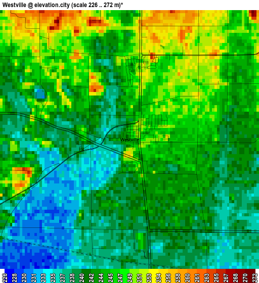
Below is the Elevation map of Westville, which displays elevation range with different colors. Scale of the first map is from 226 to 272 m (741 to 892 ft) with average elevation of 242.9 meters (=797 ft) [note 1]
These maps also provides idea of topography and contour of this city, they are displayed at different zoom levels. More info about maps, scale and edge coordinates you can find below images.
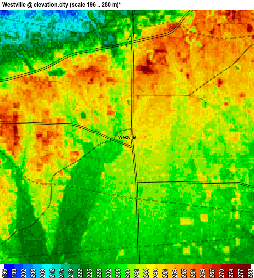
| \ | Map #1 | Map #2 | Topo.Map |
| Scale [m] | 226..272 m | 196..280 m | × |
| Scale [ft] | 741..892 ft | 643..919 ft | × |
| Average | 242.9 m = 797 ft | 240.4 m = 789 ft | × |
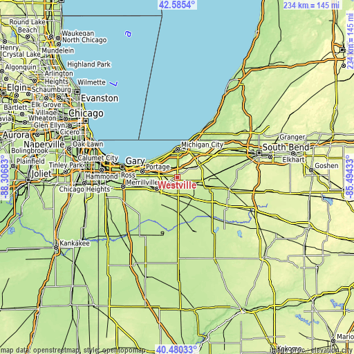
| Width | 7.31 km = 4.5 mi | 14.63 km = 9.1 mi | 234.1 km = 145.5 mi |
| Height | 7.31 km = 4.5 mi | 14.63 km = 9.1 mi | 234.1 km = 145.5 mi |
| ↑Max Latitude | 41.574314° | 41.607181° | 42.5854° |
| Latitude at center | 41.54143° | 41.54143° | 41.54143° |
| ↓Min Latitude | 41.50853° | 41.475612° | 40.48033° |
| ← Min Longitude | -86.944525° | -86.988471° | -88.30683° |
| Longitude center | -86.90058° | -86.90058° | -86.90058° |
| →Max Longitude | -86.856635° | -86.812689° | -85.49433° |
Nearby cities:
Cities around Westville sort by population:
• Valparaiso elevation 249 m
15.4 km,  240°
240°
• Michigan City 192 m
18.5 km,  1°
1°
• LaPorte 252 m
16.7 km,  62°
62°
• La Porte 249 m
17.2 km, 64°
• Chesterton 198 m
15.6 km,  299°
299°
• South Haven 203 m
19.7 km,  270°
270°
• Porter 198 m
16.6 km, 299°
• Trail Creek 200 m
17.8 km,  11°
11°
• Aberdeen 226 m
20.9 km, 237°
• Burns Harbor 193 m
21.5 km, 295°
• Kingsford Heights 222 m
18.7 km,  111°
111°
• Wanatah 226 m
12.3 km,  179°
179°
Multilingual:
 En español:
Westville elevación 244 m.
 En France:
Westville élévation 244 m.
 Auf Deutsch:
Westville höhe über dem Meeresspiegel ist 244 m.

Sources and notes:
- [note 1] Map square and city borders are not equal. Map elevation data is calculated only from area inside that square.
- [src 1] Elevation data from geonames database provided with same terms of usage.
- [src 2] The elevation map of Westville is generated using elevation data from NASA's 3 arcsec (90m) resolution SRTM data.
- [src 3] Base (background) map © OpenStreetMap contributors tiles are generated by Geofabrik and OpenTopoMap.
Copyright & License:
This Westville Elevation Map is licensed under CC BY-SA. You may reuse any part from this page, if you give a proper credit by linking to this URL:
 More info on terms of use page.