Monon elevation
Monon (Indiana, White County), United States elevation is 209 meters and Monon elevation in feet is 686 ft above sea level [src 1]. Monon is a populated place (feature code) with elevation that is 70 meters (230 ft) smaller than average city elevation in United States.
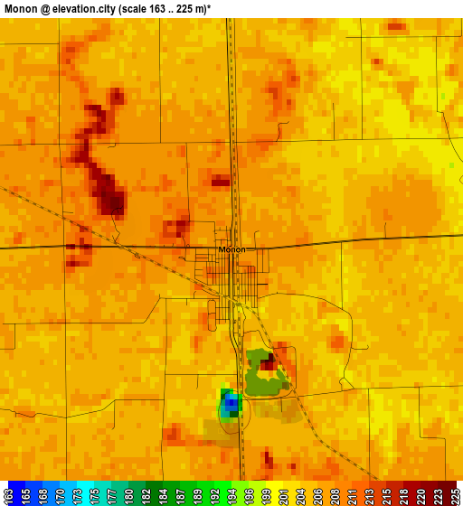
Below is the Elevation map of Monon, which displays elevation range with different colors. Scale of the first map is from 163 to 225 m (535 to 738 ft) with average elevation of 205.4 meters (=674 ft) [note 1]
These maps also provides idea of topography and contour of this city, they are displayed at different zoom levels. More info about maps, scale and edge coordinates you can find below images.
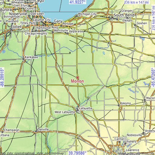
| \ | Map #1 | Topo.Map |
| Scale [m] | 163..225 m | × |
| Scale [ft] | 535..738 ft | × |
| Average | 205.4 m = 674 ft | × |
| Width | 7.39 km = 4.6 mi | 236.5 km = 147 mi |
| Height | 7.39 km = 4.6 mi | 236.5 km = 147 mi |
| ↑Max Latitude | 40.901044° | 41.9227° |
| Latitude at center | 40.86782° | 40.86782° |
| ↓Min Latitude | 40.834579° | 39.79586° |
| ← Min Longitude | -86.922845° | -88.28515° |
| Longitude center | -86.8789° | -86.8789° |
| →Max Longitude | -86.834955° | -85.47265° |
Nearby cities:
Cities around Monon sort by population:
• Rensselaer elevation 204 m
24.1 km,  288°
288°
• Monticello 206 m
16.7 km,  144°
144°
• Georgetown 181 m
34.5 km,  114°
114°
• Delphi 176 m
35.6 km,  151°
151°
• Dunkirk 187 m
42.7 km, 106°
• Winamac 217 m
30.9 km,  48°
48°
• North Judson 219 m
39.6 km,  12°
12°
• Brookston 209 m
29.5 km,  178°
178°
• Battle Ground 181 m
40.1 km, 175°
• Bass Lake 220 m
44.3 km,  31°
31°
• Remington 226 m
25.8 km,  242°
242°
• Goodland 222 m
36.8 km,  251°
251°
Multilingual:
 En español:
Monon elevación 209 m.
 En France:
Monon élévation 209 m.


Sources and notes:
- [note 1] Map square and city borders are not equal. Map elevation data is calculated only from area inside that square.
- [src 1] Elevation data from geonames database provided with same terms of usage.
- [src 2] The elevation map of Monon is generated using elevation data from NASA's 3 arcsec (90m) resolution SRTM data.
- [src 3] Base (background) map © OpenStreetMap contributors tiles are generated by Geofabrik and OpenTopoMap.
Copyright & License:
This Monon Elevation Map is licensed under CC BY-SA. You may reuse any part from this page, if you give a proper credit by linking to this URL:
 More info on terms of use page.