Granger elevation
Granger (Indiana, Saint Joseph County), United States elevation is 243 meters and Granger elevation in feet is 797 ft above sea level [src 1]. Granger is a populated place (feature code) with elevation that is 36 meters (118 ft) smaller than average city elevation in United States.
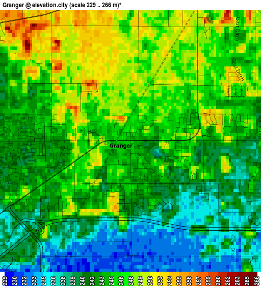
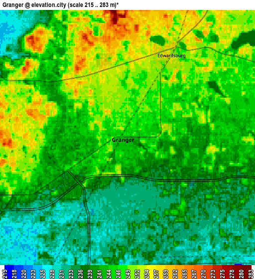
Below is the Elevation map of Granger, which displays elevation range with different colors. Scale of the first map is from 229 to 266 m (751 to 873 ft) with average elevation of 243.9 meters (=800 ft) [note 1]
These maps also provides idea of topography and contour of this city, they are displayed at different zoom levels. More info about maps, scale and edge coordinates you can find below images.
| \ | Map #1 | Map #2 | Topo.Map |
| Scale [m] | 229..266 m | 215..283 m | × |
| Scale [ft] | 751..873 ft | 705..928 ft | × |
| Average | 243.9 m = 800 ft | 243.1 m = 798 ft | × |
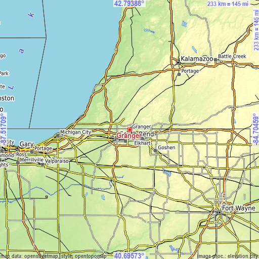
| Width | 7.29 km = 4.5 mi | 14.58 km = 9.1 mi | 233.3 km = 145 mi |
| Height | 7.29 km = 4.5 mi | 14.58 km = 9.1 mi | 233.3 km = 145 mi |
| ↑Max Latitude | 41.786156° | 41.818915° | 42.79388° |
| Latitude at center | 41.75338° | 41.75338° | 41.75338° |
| ↓Min Latitude | 41.720588° | 41.687779° | 40.69573° |
| ← Min Longitude | -86.154785° | -86.198731° | -87.51709° |
| Longitude center | -86.11084° | -86.11084° | -86.11084° |
| →Max Longitude | -86.066895° | -86.022949° | -84.70459° |
Nearby cities:
Cities around Granger sort by population:
• South Bend elevation 213 m
13.9 km,  236°
236°
• Elkhart 232 m
13.7 km,  125°
125°
• Mishawaka 220 m
10.9 km,  201°
201°
• Niles 211 m
14.6 km,  305°
305°
• Dunlap 238 m
20.3 km, 129°
• Notre Dame 227 m
12.1 km, 240°
• Simonton Lake 245 m
11.3 km,  89°
89°
• Georgetown 223 m
10.1 km,  254°
254°
• Gulivoire Park 261 m
19.2 km,  215°
215°
• Osceola 229 m
10.2 km,  163°
163°
• Cassopolis 272 m
19.5 km,  25°
25°
• Edwardsburg 253 m
5.3 km, 27°
Multilingual:
 En español:
Granger elevación 243 m.
 En France:
Granger élévation 243 m.


Sources and notes:
- [note 1] Map square and city borders are not equal. Map elevation data is calculated only from area inside that square.
- [src 1] Elevation data from geonames database provided with same terms of usage.
- [src 2] The elevation map of Granger is generated using elevation data from NASA's 3 arcsec (90m) resolution SRTM data.
- [src 3] Base (background) map © OpenStreetMap contributors tiles are generated by Geofabrik and OpenTopoMap.
Copyright & License:
This Granger Elevation Map is licensed under CC BY-SA. You may reuse any part from this page, if you give a proper credit by linking to this URL:
 More info on terms of use page.