Dyer elevation
Dyer (Indiana, Lake County), United States elevation is 197 meters and Dyer elevation in feet is 646 ft above sea level [src 1]. Dyer is a populated place (feature code) with elevation that is 82 meters (269 ft) smaller than average city elevation in United States.
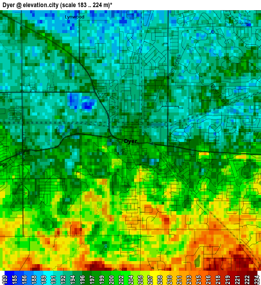
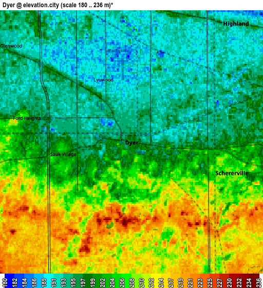
Below is the Elevation map of Dyer, which displays elevation range with different colors. Scale of the first map is from 183 to 224 m (600 to 735 ft) with average elevation of 198.4 meters (=651 ft) [note 1]
These maps also provides idea of topography and contour of this city, they are displayed at different zoom levels. More info about maps, scale and edge coordinates you can find below images.
| \ | Map #1 | Map #2 | Topo.Map |
| Scale [m] | 183..224 m | 180..236 m | × |
| Scale [ft] | 600..735 ft | 591..774 ft | × |
| Average | 198.4 m = 651 ft | 201.9 m = 662 ft | × |
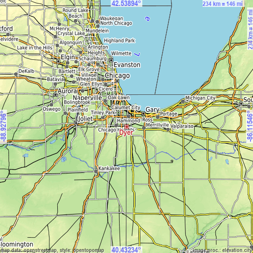
| Width | 7.32 km = 4.5 mi | 14.64 km = 9.1 mi | 234.2 km = 145.5 mi |
| Height | 7.32 km = 4.5 mi | 14.64 km = 9.1 mi | 234.2 km = 145.5 mi |
| ↑Max Latitude | 41.527108° | 41.559999° | 42.53894° |
| Latitude at center | 41.4942° | 41.4942° | 41.4942° |
| ↓Min Latitude | 41.461276° | 41.428334° | 40.43234° |
| ← Min Longitude | -87.565655° | -87.609601° | -88.92796° |
| Longitude center | -87.52171° | -87.52171° | -87.52171° |
| →Max Longitude | -87.477765° | -87.433819° | -86.11546° |
Nearby cities:
Cities around Dyer sort by population:
• Chicago Heights elevation 202 m
9.6 km,  277°
277°
• Schererville 207 m
5.8 km,  106°
106°
• Lansing 192 m
8 km,  349°
349°
• Munster 188 m
7.9 km,  5°
5°
• Highland 193 m
8.8 km,  41°
41°
• Griffith 197 m
9 km,  65°
65°
• Saint John 224 m
6.5 km,  138°
138°
• Sauk Village 201 m
3.9 km,  260°
260°
• Lynwood 190 m
3.9 km,  338°
338°
• Glenwood 192 m
8.6 km,  308°
308°
• Ford Heights 206 m
6 km, 283°
• Willowbrook 223 m
4.2 km,  196°
196°
Multilingual:
 En español:
Dyer elevación 197 m.
 En France:
Dyer élévation 197 m.


Sources and notes:
- [note 1] Map square and city borders are not equal. Map elevation data is calculated only from area inside that square.
- [src 1] Elevation data from geonames database provided with same terms of usage.
- [src 2] The elevation map of Dyer is generated using elevation data from NASA's 3 arcsec (90m) resolution SRTM data.
- [src 3] Base (background) map © OpenStreetMap contributors tiles are generated by Geofabrik and OpenTopoMap.
Copyright & License:
This Dyer Elevation Map is licensed under CC BY-SA. You may reuse any part from this page, if you give a proper credit by linking to this URL:
 More info on terms of use page.