Ford Heights elevation
Ford Heights (Illinois, Cook County), United States elevation is 206 meters and Ford Heights elevation in feet is 676 ft above sea level [src 1]. Ford Heights is a populated place (feature code) with elevation that is 73 meters (240 ft) smaller than average city elevation in United States.
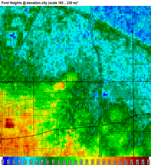
Below is the Elevation map of Ford Heights, which displays elevation range with different colors. Scale of the first map is from 183 to 230 m (600 to 755 ft) with average elevation of 199 meters (=653 ft) [note 1]
These maps also provides idea of topography and contour of this city, they are displayed at different zoom levels. More info about maps, scale and edge coordinates you can find below images.
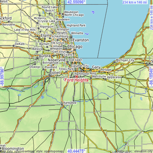
| \ | Map #1 | Topo.Map |
| Scale [m] | 183..230 m | × |
| Scale [ft] | 600..755 ft | × |
| Average | 199 m = 653 ft | × |
| Width | 7.32 km = 4.5 mi | 234.2 km = 145.5 mi |
| Height | 7.32 km = 4.5 mi | 234.2 km = 145.5 mi |
| ↑Max Latitude | 41.539321° | 42.55096° |
| Latitude at center | 41.50642° | 41.50642° |
| ↓Min Latitude | 41.473502° | 40.44475° |
| ← Min Longitude | -87.635655° | -88.99796° |
| Longitude center | -87.59171° | -87.59171° |
| →Max Longitude | -87.547765° | -86.18546° |
Nearby cities:
Cities around Ford Heights sort by population:
• Chicago Heights elevation 202 m
3.7 km,  269°
269°
• Park Forest 218 m
7.1 km,  256°
256°
• Dyer 197 m
6 km,  103°
103°
• Sauk Village 201 m
2.8 km,  134°
134°
• Steger 218 m
5.5 km,  222°
222°
• Lynwood 190 m
4.9 km,  63°
63°
• Glenwood 192 m
4.1 km,  347°
347°
• Crete 225 m
7.6 km,  205°
205°
• Olympia Fields 211 m
6.9 km,  276°
276°
• South Chicago Heights 220 m
4.8 km,  233°
233°
• Thornton 186 m
7 km, 348°
• Willowbrook 223 m
7.1 km,  139°
139°
Multilingual:
 En español:
Ford Heights elevación 206 m.
 En France:
Ford Heights élévation 206 m.
 Auf Deutsch:
Ford Heights höhe über dem Meeresspiegel ist 206 m.

Sources and notes:
- [note 1] Map square and city borders are not equal. Map elevation data is calculated only from area inside that square.
- [src 1] Elevation data from geonames database provided with same terms of usage.
- [src 2] The elevation map of Ford Heights is generated using elevation data from NASA's 3 arcsec (90m) resolution SRTM data.
- [src 3] Base (background) map © OpenStreetMap contributors tiles are generated by Geofabrik and OpenTopoMap.
Copyright & License:
This Ford Heights Elevation Map is licensed under CC BY-SA. You may reuse any part from this page, if you give a proper credit by linking to this URL:
 More info on terms of use page.