Winthrop Harbor elevation
Winthrop Harbor (Illinois, Lake County), United States elevation is 195 meters and Winthrop Harbor elevation in feet is 640 ft above sea level [src 1]. Winthrop Harbor is a populated place (feature code) with elevation that is 84 meters (276 ft) smaller than average city elevation in United States.
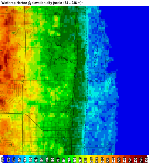
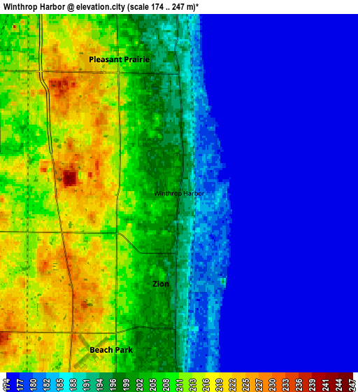
Below is the Elevation map of Winthrop Harbor, which displays elevation range with different colors. Scale of the first map is from 174 to 238 m (571 to 781 ft) with average elevation of 194.2 meters (=637 ft) [note 1]
These maps also provides idea of topography and contour of this city, they are displayed at different zoom levels. More info about maps, scale and edge coordinates you can find below images.
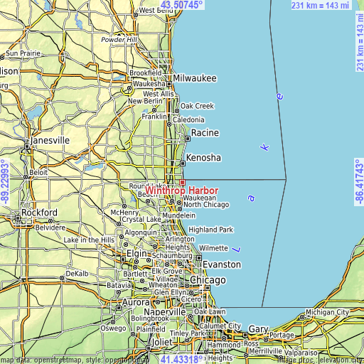
| \ | Map #1 | Map #2 | Topo.Map |
| Scale [m] | 174..238 m | 174..247 m | × |
| Scale [ft] | 571..781 ft | 571..810 ft | × |
| Average | 194.2 m = 637 ft | 194.9 m = 639 ft | × |
| Width | 7.21 km = 4.5 mi | 14.42 km = 9 mi | 230.6 km = 143.3 mi |
| Height | 7.21 km = 4.5 mi | 14.41 km = 9 mi | 230.6 km = 143.3 mi |
| ↑Max Latitude | 42.511312° | 42.543698° | 43.50745° |
| Latitude at center | 42.47891° | 42.47891° | 42.47891° |
| ↓Min Latitude | 42.446491° | 42.414055° | 41.43318° |
| ← Min Longitude | -87.867625° | -87.911571° | -89.22993° |
| Longitude center | -87.82368° | -87.82368° | -87.82368° |
| →Max Longitude | -87.779735° | -87.735789° | -86.41743° |
Nearby cities:
Cities around Winthrop Harbor sort by population:
• Kenosha elevation 185 m
11.8 km,  0°
0°
• Waukegan 199 m
12.9 km,  187°
187°
• Gurnee 208 m
13.7 km,  208°
208°
• North Chicago 205 m
17.1 km,  184°
184°
• Zion 201 m
3.7 km, 191°
• Pleasant Prairie 214 m
12.2 km,  312°
312°
• Lindenhurst 247 m
18.3 km,  245°
245°
• Beach Park 215 m
6.9 km,  203°
203°
• Gages Lake 237 m
19.2 km,  222°
222°
• Park City 214 m
15.3 km, 198°
• Grandwood Park 229 m
16.4 km,  234°
234°
• Wadsworth 218 m
9.9 km,  235°
235°
Multilingual:
 En español:
Winthrop Harbor elevación 195 m.
 En France:
Winthrop Harbor élévation 195 m.
 Auf Deutsch:
Winthrop Harbor höhe über dem Meeresspiegel ist 195 m.

Sources and notes:
- [note 1] Map square and city borders are not equal. Map elevation data is calculated only from area inside that square.
- [src 1] Elevation data from geonames database provided with same terms of usage.
- [src 2] The elevation map of Winthrop Harbor is generated using elevation data from NASA's 3 arcsec (90m) resolution SRTM data.
- [src 3] Base (background) map © OpenStreetMap contributors tiles are generated by Geofabrik and OpenTopoMap.
Copyright & License:
This Winthrop Harbor Elevation Map is licensed under CC BY-SA. You may reuse any part from this page, if you give a proper credit by linking to this URL:
 More info on terms of use page.