Watseka elevation
Watseka (Illinois, Iroquois County), United States elevation is 194 meters and Watseka elevation in feet is 636 ft above sea level [src 1]. Watseka is a seat of a second-order administrative division (feature code) with elevation that is 85 meters (279 ft) smaller than average city elevation in United States.
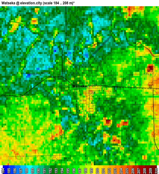
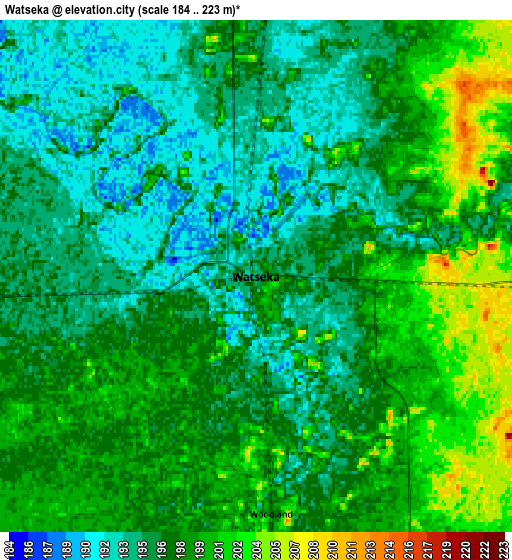
Below is the Elevation map of Watseka, which displays elevation range with different colors. Scale of the first map is from 184 to 208 m (604 to 682 ft) with average elevation of 194.1 meters (=637 ft) [note 1]
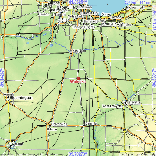
These maps also provides idea of topography and contour of this city, they are displayed at different zoom levels. More info about maps, scale and edge coordinates you can find below images.
| \ | Map #1 | Map #2 | Topo.Map |
| Scale [m] | 184..208 m | 184..223 m | × |
| Scale [ft] | 604..682 ft | 604..732 ft | × |
| Average | 194.1 m = 637 ft | 196.7 m = 645 ft | × |
| Width | 7.4 km = 4.6 mi | 14.8 km = 9.2 mi | 236.8 km = 147.1 mi |
| Height | 7.4 km = 4.6 mi | 14.8 km = 9.2 mi | 236.8 km = 147.1 mi |
| ↑Max Latitude | 40.80942° | 40.842673° | 41.83251° |
| Latitude at center | 40.77615° | 40.77615° | 40.77615° |
| ↓Min Latitude | 40.742863° | 40.70956° | 39.70273° |
| ← Min Longitude | -87.780365° | -87.824311° | -89.14267° |
| Longitude center | -87.73642° | -87.73642° | -87.73642° |
| →Max Longitude | -87.692475° | -87.648529° | -86.33017° |
Nearby cities:
Cities around Watseka sort by population:
• Hoopeston elevation 224 m
34.8 km,  170°
170°
• Fowler 254 m
39.3 km,  116°
116°
• Gilman 201 m
21.6 km,  267°
267°
• Kentland 211 m
24.5 km,  91°
91°
• Clifton 207 m
24.3 km,  316°
316°
• Onarga 206 m
23.7 km,  253°
253°
• Saint Anne 204 m
27.7 km,  3°
3°
• Milford 206 m
16.8 km, 168°
• Morocco 213 m
30.4 km,  51°
51°
• Sheldon 211 m
14.5 km, 93°
• Chebanse 206 m
29.1 km,  330°
330°
• Goodland 222 m
37.3 km, 92°
Multilingual:
 En español:
Watseka elevación 194 m.
 En France:
Watseka élévation 194 m.


Sources and notes:
- [note 1] Map square and city borders are not equal. Map elevation data is calculated only from area inside that square.
- [src 1] Elevation data from geonames database provided with same terms of usage.
- [src 2] The elevation map of Watseka is generated using elevation data from NASA's 3 arcsec (90m) resolution SRTM data.
- [src 3] Base (background) map © OpenStreetMap contributors tiles are generated by Geofabrik and OpenTopoMap.
Copyright & License:
This Watseka Elevation Map is licensed under CC BY-SA. You may reuse any part from this page, if you give a proper credit by linking to this URL:
 More info on terms of use page.