Chebanse elevation
Chebanse (Illinois, Kankakee County), United States elevation is 206 meters and Chebanse elevation in feet is 676 ft above sea level [src 1]. Chebanse is a populated place (feature code) with elevation that is 73 meters (240 ft) smaller than average city elevation in United States.
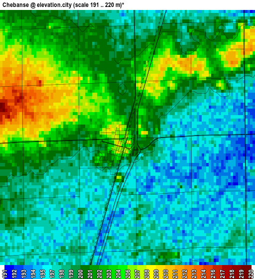
Below is the Elevation map of Chebanse, which displays elevation range with different colors. Scale of the first map is from 191 to 220 m (627 to 722 ft) with average elevation of 199.9 meters (=656 ft) [note 1]
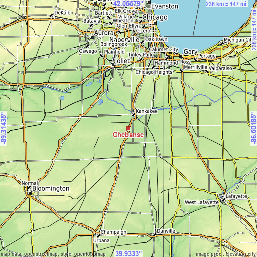
These maps also provides idea of topography and contour of this city, they are displayed at different zoom levels. More info about maps, scale and edge coordinates you can find below images.
| \ | Map #1 | Topo.Map |
| Scale [m] | 191..220 m | × |
| Scale [ft] | 627..722 ft | × |
| Average | 199.9 m = 656 ft | × |
| Width | 7.38 km = 4.6 mi | 236 km = 146.6 mi |
| Height | 7.38 km = 4.6 mi | 236 km = 146.6 mi |
| ↑Max Latitude | 41.036246° | 42.05579° |
| Latitude at center | 41.00309° | 41.00309° |
| ↓Min Latitude | 40.969917° | 39.9333° |
| ← Min Longitude | -87.952045° | -89.31435° |
| Longitude center | -87.9081° | -87.9081° |
| →Max Longitude | -87.864155° | -86.50185° |
Nearby cities:
Cities around Chebanse sort by population:
• Kankakee elevation 206 m
13.6 km,  16°
16°
• Bourbonnais 209 m
16.8 km,  5°
5°
• Bradley 196 m
15.9 km, 14°
• Manteno 213 m
28.3 km, 13°
• Watseka 194 m
29.1 km,  150°
150°
• Momence 196 m
27.5 km,  48°
48°
• Gilman 201 m
27.2 km,  195°
195°
• Limestone 203 m
15.2 km,  340°
340°
• Herscher 204 m
16.7 km,  287°
287°
• Clifton 207 m
7.9 km, 196°
• Onarga 206 m
33.1 km,  194°
194°
• Saint Anne 204 m
16.5 km,  81°
81°
Multilingual:
 En español:
Chebanse elevación 206 m.
 En France:
Chebanse élévation 206 m.
 Auf Deutsch:
Chebanse höhe über dem Meeresspiegel ist 206 m.

Sources and notes:
- [note 1] Map square and city borders are not equal. Map elevation data is calculated only from area inside that square.
- [src 1] Elevation data from geonames database provided with same terms of usage.
- [src 2] The elevation map of Chebanse is generated using elevation data from NASA's 3 arcsec (90m) resolution SRTM data.
- [src 3] Base (background) map © OpenStreetMap contributors tiles are generated by Geofabrik and OpenTopoMap.
Copyright & License:
This Chebanse Elevation Map is licensed under CC BY-SA. You may reuse any part from this page, if you give a proper credit by linking to this URL:
 More info on terms of use page.