Sterling elevation
Sterling (Illinois, Whiteside County), United States elevation is 203 meters and Sterling elevation in feet is 666 ft above sea level [src 1]. Sterling is a populated place (feature code) with elevation that is 76 meters (249 ft) smaller than average city elevation in United States.
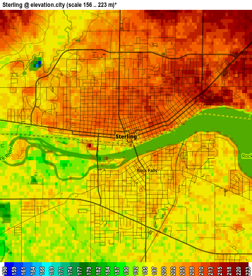
Below is the Elevation map of Sterling, which displays elevation range with different colors. Scale of the first map is from 156 to 223 m (512 to 732 ft) with average elevation of 201 meters (=659 ft) [note 1]
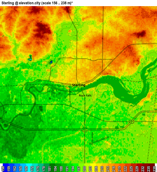
These maps also provides idea of topography and contour of this city, they are displayed at different zoom levels. More info about maps, scale and edge coordinates you can find below images.
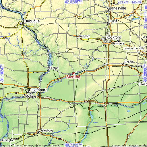
| \ | Map #1 | Map #2 | Topo.Map |
| Scale [m] | 156..223 m | 156..238 m | × |
| Scale [ft] | 512..732 ft | 512..781 ft | × |
| Average | 201 m = 659 ft | 202.1 m = 663 ft | × |
| Width | 7.29 km = 4.5 mi | 14.57 km = 9.1 mi | 233.2 km = 144.9 mi |
| Height | 7.29 km = 4.5 mi | 14.57 km = 9.1 mi | 233.2 km = 144.9 mi |
| ↑Max Latitude | 41.821398° | 41.854138° | 42.82857° |
| Latitude at center | 41.78864° | 41.78864° | 41.78864° |
| ↓Min Latitude | 41.755866° | 41.723075° | 40.73157° |
| ← Min Longitude | -89.740165° | -89.784111° | -91.10247° |
| Longitude center | -89.69622° | -89.69622° | -89.69622° |
| →Max Longitude | -89.652275° | -89.608329° | -88.28997° |
Nearby cities:
Cities around Sterling sort by population:
• Dixon elevation 214 m
18.8 km,  72°
72°
• Rock Falls 200 m
1.2 km,  148°
148°
• Morrison 209 m
22.4 km,  276°
276°
• Mount Morris 281 m
36.4 km,  36°
36°
• Carthage 244 m
34.8 km, 65°
• Amboy 230 m
31.6 km,  105°
105°
• Polo 264 m
24 km,  23°
23°
• Prophetstown 191 m
23.8 km,  236°
236°
• Erie 183 m
35 km,  245°
245°
• Forreston 288 m
38.8 km,  14°
14°
• Lanark 269 m
36.7 km,  341°
341°
• Walnut 213 m
27.2 km,  161°
161°
Multilingual:
 En español:
Sterling elevación 203 m.
 En France:
Sterling élévation 203 m.
 Auf Deutsch:
Sterling höhe über dem Meeresspiegel ist 203 m.

Sources and notes:
- [note 1] Map square and city borders are not equal. Map elevation data is calculated only from area inside that square.
- [src 1] Elevation data from geonames database provided with same terms of usage.
- [src 2] The elevation map of Sterling is generated using elevation data from NASA's 3 arcsec (90m) resolution SRTM data.
- [src 3] Base (background) map © OpenStreetMap contributors tiles are generated by Geofabrik and OpenTopoMap.
Copyright & License:
This Sterling Elevation Map is licensed under CC BY-SA. You may reuse any part from this page, if you give a proper credit by linking to this URL:
 More info on terms of use page.