Schiller Park elevation
Schiller Park (Illinois, Cook County), United States elevation is 197 meters and Schiller Park elevation in feet is 646 ft above sea level [src 1]. Schiller Park is a populated place (feature code) with elevation that is 82 meters (269 ft) smaller than average city elevation in United States.
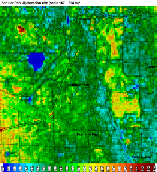
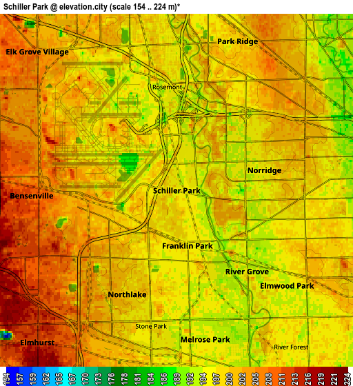
Below is the Elevation map of Schiller Park, which displays elevation range with different colors. Scale of the first map is from 187 to 214 m (614 to 702 ft) with average elevation of 197.2 meters (=647 ft) [note 1]
These maps also provides idea of topography and contour of this city, they are displayed at different zoom levels. More info about maps, scale and edge coordinates you can find below images.
| \ | Map #1 | Map #2 | Topo.Map |
| Scale [m] | 187..214 m | 154..224 m | × |
| Scale [ft] | 614..702 ft | 505..735 ft | × |
| Average | 197.2 m = 647 ft | 199.9 m = 656 ft | × |
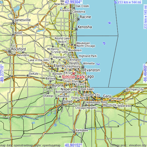
| Width | 7.27 km = 4.5 mi | 14.53 km = 9 mi | 232.6 km = 144.5 mi |
| Height | 7.27 km = 4.5 mi | 14.53 km = 9 mi | 232.5 km = 144.5 mi |
| ↑Max Latitude | 41.988532° | 42.021187° | 42.99304° |
| Latitude at center | 41.95586° | 41.95586° | 41.95586° |
| ↓Min Latitude | 41.923171° | 41.890466° | 40.90152° |
| ← Min Longitude | -87.914845° | -87.958791° | -89.27715° |
| Longitude center | -87.8709° | -87.8709° | -87.8709° |
| →Max Longitude | -87.826955° | -87.783009° | -86.46465° |
Nearby cities:
Cities around Schiller Park sort by population:
• Park Ridge elevation 199 m
6.6 km,  22°
22°
• Melrose Park 194 m
6.3 km,  169°
169°
• Elmwood Park 198 m
6.4 km,  127°
127°
• Bensenville 209 m
5.7 km,  269°
269°
• Franklin Park 196 m
2.3 km, 169°
• Norridge 197 m
3.7 km,  76°
76°
• Northlake 198 m
4.8 km,  205°
205°
• River Grove 193 m
4.4 km,  139°
139°
• Harwood Heights 200 m
5.4 km, 76°
• Berkeley 201 m
7.9 km,  199°
199°
• Stone Park 195 m
5.7 km,  190°
190°
• Rosemont 196 m
4.5 km,  345°
345°
Multilingual:
 En español:
Schiller Park elevación 197 m.
 En France:
Schiller Park élévation 197 m.
 Auf Deutsch:
Schiller Park höhe über dem Meeresspiegel ist 197 m.

Sources and notes:
- [note 1] Map square and city borders are not equal. Map elevation data is calculated only from area inside that square.
- [src 1] Elevation data from geonames database provided with same terms of usage.
- [src 2] The elevation map of Schiller Park is generated using elevation data from NASA's 3 arcsec (90m) resolution SRTM data.
- [src 3] Base (background) map © OpenStreetMap contributors tiles are generated by Geofabrik and OpenTopoMap.
Copyright & License:
This Schiller Park Elevation Map is licensed under CC BY-SA. You may reuse any part from this page, if you give a proper credit by linking to this URL:
 More info on terms of use page.