Bensenville elevation
Bensenville (Illinois, DuPage County), United States elevation is 209 meters and Bensenville elevation in feet is 686 ft above sea level [src 1]. Bensenville is a populated place (feature code) with elevation that is 70 meters (230 ft) smaller than average city elevation in United States.
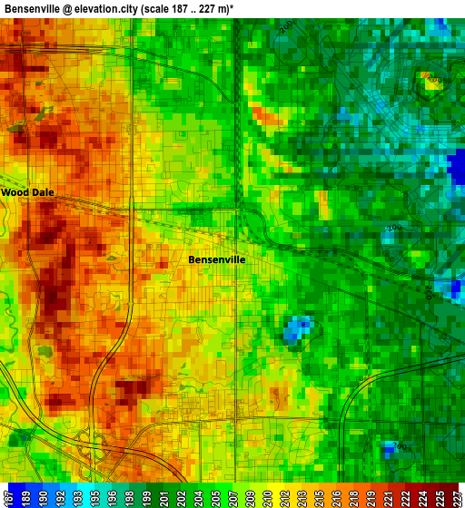
Below is the Elevation map of Bensenville, which displays elevation range with different colors. Scale of the first map is from 187 to 227 m (614 to 745 ft) with average elevation of 207.8 meters (=682 ft) [note 1]
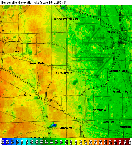
These maps also provides idea of topography and contour of this city, they are displayed at different zoom levels. More info about maps, scale and edge coordinates you can find below images.
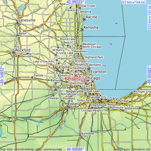
| \ | Map #1 | Map #2 | Topo.Map |
| Scale [m] | 187..227 m | 154..250 m | × |
| Scale [ft] | 614..745 ft | 505..820 ft | × |
| Average | 207.8 m = 682 ft | 206.9 m = 679 ft | × |
| Width | 7.27 km = 4.5 mi | 14.54 km = 9 mi | 232.6 km = 144.5 mi |
| Height | 7.27 km = 4.5 mi | 14.54 km = 9 mi | 232.6 km = 144.5 mi |
| ↑Max Latitude | 41.987702° | 42.020358° | 42.99223° |
| Latitude at center | 41.95503° | 41.95503° | 41.95503° |
| ↓Min Latitude | 41.922341° | 41.889635° | 40.90068° |
| ← Min Longitude | -87.984015° | -88.027961° | -89.34632° |
| Longitude center | -87.94007° | -87.94007° | -87.94007° |
| →Max Longitude | -87.896125° | -87.852179° | -86.53382° |
Nearby cities:
Cities around Bensenville sort by population:
• Elmhurst elevation 212 m
6.2 km,  180°
180°
• Addison 212 m
4.8 km,  237°
237°
• Elk Grove Village 209 m
6 km,  335°
335°
• Villa Park 215 m
8.3 km,  209°
209°
• Franklin Park 196 m
6.5 km,  109°
109°
• Wood Dale 211 m
3.3 km,  286°
286°
• Northlake 198 m
5.6 km,  138°
138°
• Schiller Park 197 m
5.7 km,  89°
89°
• Itasca 218 m
6 km, 291°
• Berkeley 201 m
8 km,  157°
157°
• Stone Park 195 m
7.2 km, 139°
• Rosemont 196 m
6.4 km,  45°
45°
Multilingual:
 En español:
Bensenville elevación 209 m.
 En France:
Bensenville élévation 209 m.
 Auf Deutsch:
Bensenville höhe über dem Meeresspiegel ist 209 m.

Sources and notes:
- [note 1] Map square and city borders are not equal. Map elevation data is calculated only from area inside that square.
- [src 1] Elevation data from geonames database provided with same terms of usage.
- [src 2] The elevation map of Bensenville is generated using elevation data from NASA's 3 arcsec (90m) resolution SRTM data.
- [src 3] Base (background) map © OpenStreetMap contributors tiles are generated by Geofabrik and OpenTopoMap.
Copyright & License:
This Bensenville Elevation Map is licensed under CC BY-SA. You may reuse any part from this page, if you give a proper credit by linking to this URL:
 More info on terms of use page.