Minooka elevation
Minooka (Illinois, Grundy County), United States elevation is 186 meters and Minooka elevation in feet is 610 ft above sea level [src 1]. Minooka is a populated place (feature code) with elevation that is 93 meters (305 ft) smaller than average city elevation in United States.
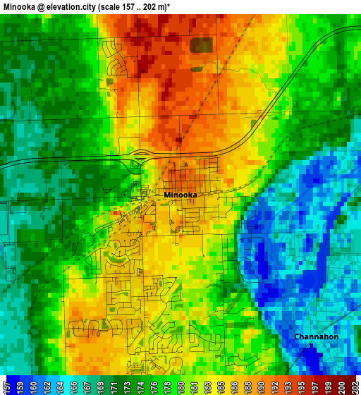
Below is the Elevation map of Minooka, which displays elevation range with different colors. Scale of the first map is from 157 to 202 m (515 to 663 ft) with average elevation of 177.6 meters (=583 ft) [note 1]
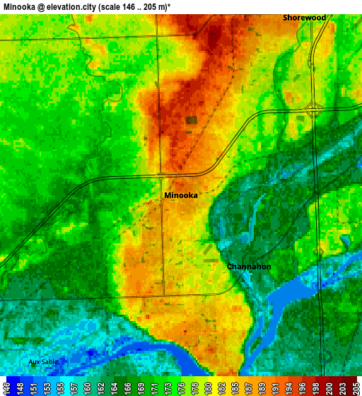
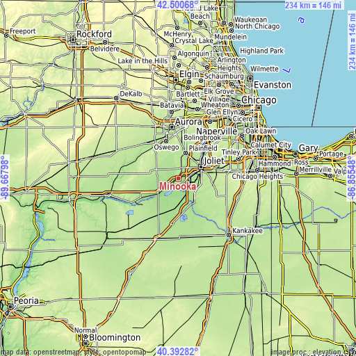
These maps also provides idea of topography and contour of this city, they are displayed at different zoom levels. More info about maps, scale and edge coordinates you can find below images.
| \ | Map #1 | Map #2 | Topo.Map |
| Scale [m] | 157..202 m | 146..205 m | × |
| Scale [ft] | 515..663 ft | 479..673 ft | × |
| Average | 177.6 m = 583 ft | 173.4 m = 569 ft | × |
| Width | 7.32 km = 4.5 mi | 14.65 km = 9.1 mi | 234.4 km = 145.6 mi |
| Height | 7.32 km = 4.5 mi | 14.65 km = 9.1 mi | 234.4 km = 145.6 mi |
| ↑Max Latitude | 41.488237° | 41.521148° | 42.50068° |
| Latitude at center | 41.45531° | 41.45531° | 41.45531° |
| ↓Min Latitude | 41.422366° | 41.389405° | 40.39282° |
| ← Min Longitude | -88.305675° | -88.349621° | -89.66798° |
| Longitude center | -88.26173° | -88.26173° | -88.26173° |
| →Max Longitude | -88.217785° | -88.173839° | -86.85548° |
Nearby cities:
Cities around Minooka sort by population:
• Joliet elevation 167 m
16.8 km,  62°
62°
• Crest Hill 198 m
17.5 km,  50°
50°
• Shorewood 181 m
8.8 km,  34°
34°
• Morris 159 m
17.2 km,  230°
230°
• Channahon 163 m
4 km,  136°
136°
• Wilmington 166 m
19 km,  149°
149°
• Coal City 174 m
18.7 km,  186°
186°
• Preston Heights 195 m
15.5 km,  74°
74°
• Diamond 174 m
18.6 km,  177°
177°
• Elwood 199 m
13.7 km,  114°
114°
• Rockdale 168 m
13.5 km, 65°
• Crystal Lawns 189 m
15.4 km, 34°
Multilingual:
 En español:
Minooka elevación 186 m.
 En France:
Minooka élévation 186 m.


Sources and notes:
- [note 1] Map square and city borders are not equal. Map elevation data is calculated only from area inside that square.
- [src 1] Elevation data from geonames database provided with same terms of usage.
- [src 2] The elevation map of Minooka is generated using elevation data from NASA's 3 arcsec (90m) resolution SRTM data.
- [src 3] Base (background) map © OpenStreetMap contributors tiles are generated by Geofabrik and OpenTopoMap.
Copyright & License:
This Minooka Elevation Map is licensed under CC BY-SA. You may reuse any part from this page, if you give a proper credit by linking to this URL:
 More info on terms of use page.