Galva elevation
Galva (Illinois, Henry County), United States elevation is 260 meters and Galva elevation in feet is 853 ft above sea level [src 1]. Galva is a populated place (feature code) with elevation that is 19 meters (62 ft) smaller than average city elevation in United States.
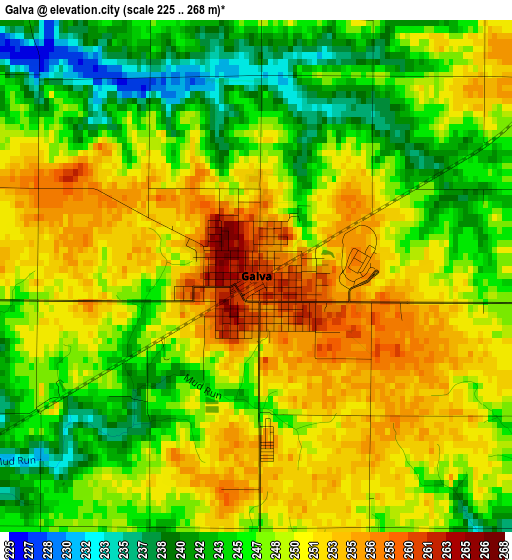
Below is the Elevation map of Galva, which displays elevation range with different colors. Scale of the first map is from 225 to 268 m (738 to 879 ft) with average elevation of 248.1 meters (=814 ft) [note 1]
These maps also provides idea of topography and contour of this city, they are displayed at different zoom levels. More info about maps, scale and edge coordinates you can find below images.
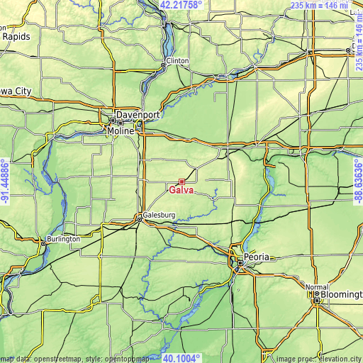
| \ | Map #1 | Topo.Map |
| Scale [m] | 225..268 m | × |
| Scale [ft] | 738..879 ft | × |
| Average | 248.1 m = 814 ft | × |
| Width | 7.36 km = 4.6 mi | 235.4 km = 146.3 mi |
| Height | 7.36 km = 4.6 mi | 235.4 km = 146.3 mi |
| ↑Max Latitude | 41.200613° | 42.21758° |
| Latitude at center | 41.16754° | 41.16754° |
| ↓Min Latitude | 41.13445° | 40.1004° |
| ← Min Longitude | -90.086555° | -91.44886° |
| Longitude center | -90.04261° | -90.04261° |
| →Max Longitude | -89.998665° | -88.63636° |
Nearby cities:
Cities around Galva sort by population:
• Galesburg elevation 237 m
36.8 km,  228°
228°
• Kewanee 260 m
13.1 km,  48°
48°
• Geneseo 201 m
32.6 km,  343°
343°
• Colona 186 m
43.7 km,  323°
323°
• Green Rock 182 m
43 km, 322°
• Knoxville 239 m
35.3 km,  215°
215°
• Cambridge 249 m
19.7 km, 320°
• Elmwood 195 m
43.8 km,  171°
171°
• Orion 237 m
35.2 km,  306°
306°
• Princeville 228 m
35.6 km,  137°
137°
• Wyoming 218 m
25.5 km,  117°
117°
• Toulon 225 m
17 km, 118°
Multilingual:
 En español:
Galva elevación 260 m.
 En France:
Galva élévation 260 m.


Sources and notes:
- [note 1] Map square and city borders are not equal. Map elevation data is calculated only from area inside that square.
- [src 1] Elevation data from geonames database provided with same terms of usage.
- [src 2] The elevation map of Galva is generated using elevation data from NASA's 3 arcsec (90m) resolution SRTM data.
- [src 3] Base (background) map © OpenStreetMap contributors tiles are generated by Geofabrik and OpenTopoMap.
Copyright & License:
This Galva Elevation Map is licensed under CC BY-SA. You may reuse any part from this page, if you give a proper credit by linking to this URL:
 More info on terms of use page.