Capron elevation
Capron (Illinois, Boone County), United States elevation is 281 meters and Capron elevation in feet is 922 ft above sea level [src 1]. Capron is a populated place (feature code) with elevation that is 2 meters (7 ft) bigger than average city elevation in United States.
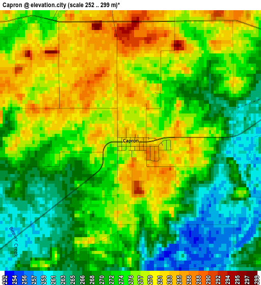
Below is the Elevation map of Capron, which displays elevation range with different colors. Scale of the first map is from 252 to 299 m (827 to 981 ft) with average elevation of 273.6 meters (=898 ft) [note 1]
These maps also provides idea of topography and contour of this city, they are displayed at different zoom levels. More info about maps, scale and edge coordinates you can find below images.
| \ | Map #1 | Topo.Map |
| Scale [m] | 252..299 m | × |
| Scale [ft] | 827..981 ft | × |
| Average | 273.6 m = 898 ft | × |
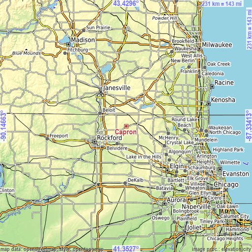
| Width | 7.22 km = 4.5 mi | 230.9 km = 143.5 mi |
| Height | 7.22 km = 4.5 mi | 230.9 km = 143.5 mi |
| ↑Max Latitude | 42.432183° | 43.4296° |
| Latitude at center | 42.39974° | 42.39974° |
| ↓Min Latitude | 42.36728° | 41.3527° |
| ← Min Longitude | -88.784325° | -90.14663° |
| Longitude center | -88.74038° | -88.74038° |
| →Max Longitude | -88.696435° | -87.33413° |
Nearby cities:
Cities around Capron sort by population:
• Belvidere elevation 243 m
17.3 km,  209°
209°
• Roscoe 228 m
22.1 km,  273°
273°
• Harvard 293 m
10.7 km,  76°
76°
• Marengo 255 m
20 km,  147°
147°
• Poplar Grove 278 m
7.6 km,  242°
242°
• Cherry Valley 226 m
25.1 km,  223°
223°
• Walworth 307 m
18.6 km,  38°
38°
• Delavan Lake 293 m
22.3 km,  23°
23°
• Clinton 295 m
20.3 km,  329°
329°
• Fontana 282 m
21.6 km, 38°
• Darien 293 m
22.6 km,  6°
6°
• Sharon 306 m
11.5 km,  4°
4°
Multilingual:
 En español:
Capron elevación 281 m.
 En France:
Capron élévation 281 m.


Sources and notes:
- [note 1] Map square and city borders are not equal. Map elevation data is calculated only from area inside that square.
- [src 1] Elevation data from geonames database provided with same terms of usage.
- [src 2] The elevation map of Capron is generated using elevation data from NASA's 3 arcsec (90m) resolution SRTM data.
- [src 3] Base (background) map © OpenStreetMap contributors tiles are generated by Geofabrik and OpenTopoMap.
Copyright & License:
This Capron Elevation Map is licensed under CC BY-SA. You may reuse any part from this page, if you give a proper credit by linking to this URL:
 More info on terms of use page.