Independence elevation
Independence (Iowa, Buchanan County), United States elevation is 285 meters and Independence elevation in feet is 935 ft above sea level [src 1]. Independence is a seat of a second-order administrative division (feature code) with elevation that is 6 meters (20 ft) bigger than average city elevation in United States.
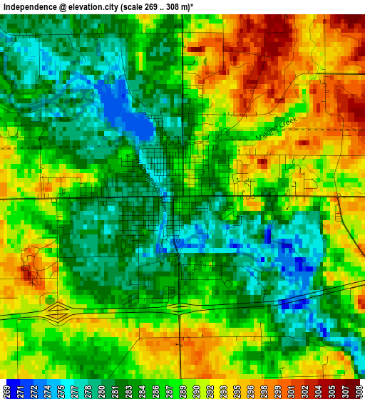
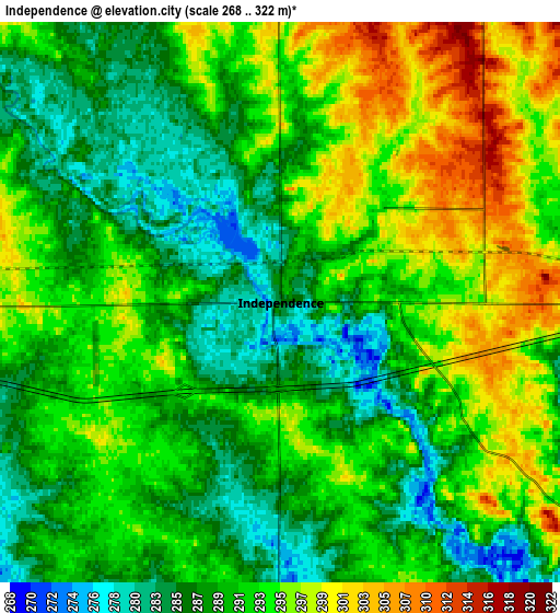
Below is the Elevation map of Independence, which displays elevation range with different colors. Scale of the first map is from 269 to 308 m (883 to 1010 ft) with average elevation of 286.6 meters (=940 ft) [note 1]
These maps also provides idea of topography and contour of this city, they are displayed at different zoom levels. More info about maps, scale and edge coordinates you can find below images.
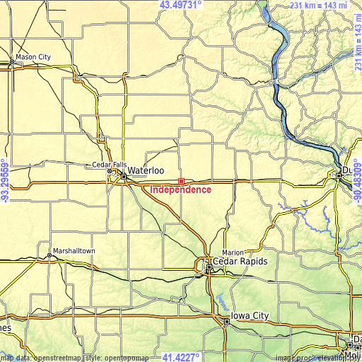
| \ | Map #1 | Map #2 | Topo.Map |
| Scale [m] | 269..308 m | 268..322 m | × |
| Scale [ft] | 883..1010 ft | 879..1056 ft | × |
| Average | 286.6 m = 940 ft | 291.5 m = 956 ft | × |
| Width | 7.21 km = 4.5 mi | 14.42 km = 9 mi | 230.7 km = 143.4 mi |
| Height | 7.21 km = 4.5 mi | 14.42 km = 9 mi | 230.7 km = 143.4 mi |
| ↑Max Latitude | 42.501008° | 42.533399° | 43.49731° |
| Latitude at center | 42.4686° | 42.4686° | 42.4686° |
| ↓Min Latitude | 42.436175° | 42.403734° | 41.4227° |
| ← Min Longitude | -91.933285° | -91.977231° | -93.29559° |
| Longitude center | -91.88934° | -91.88934° | -91.88934° |
| →Max Longitude | -91.845395° | -91.801449° | -90.48309° |
Nearby cities:
Cities around Independence sort by population:
• Waterloo elevation 263 m
37.3 km,  274°
274°
• Oelwein 317 m
22.8 km,  355°
355°
• Vinton 243 m
35.1 km,  198°
198°
• Manchester 289 m
35.6 km,  87°
87°
• Evansdale 260 m
32.1 km, 270°
• Jesup 299 m
14.3 km, 273°
• Center Point 254 m
32 km,  164°
164°
• La Porte City 253 m
30.2 km,  235°
235°
• Urbana 287 m
27.2 km,  177°
177°
• Strawberry Point 372 m
37.7 km,  50°
50°
• Elk Run Heights 260 m
30.1 km, 269°
• Fairbank 299 m
22.9 km,  325°
325°
Multilingual:
 En español:
Independence elevación 285 m.
 En France:
Independence élévation 285 m.
 Auf Deutsch:
Independence höhe über dem Meeresspiegel ist 285 m.

Sources and notes:
- [note 1] Map square and city borders are not equal. Map elevation data is calculated only from area inside that square.
- [src 1] Elevation data from geonames database provided with same terms of usage.
- [src 2] The elevation map of Independence is generated using elevation data from NASA's 3 arcsec (90m) resolution SRTM data.
- [src 3] Base (background) map © OpenStreetMap contributors tiles are generated by Geofabrik and OpenTopoMap.
Copyright & License:
This Independence Elevation Map is licensed under CC BY-SA. You may reuse any part from this page, if you give a proper credit by linking to this URL:
 More info on terms of use page.