Seymour elevation
Seymour (Connecticut, New Haven County), United States elevation is 30 meters and Seymour elevation in feet is 98 ft above sea level [src 1]. Seymour is a populated place (feature code) with elevation that is 249 meters (817 ft) smaller than average city elevation in United States.
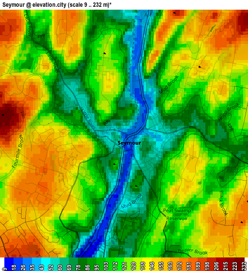
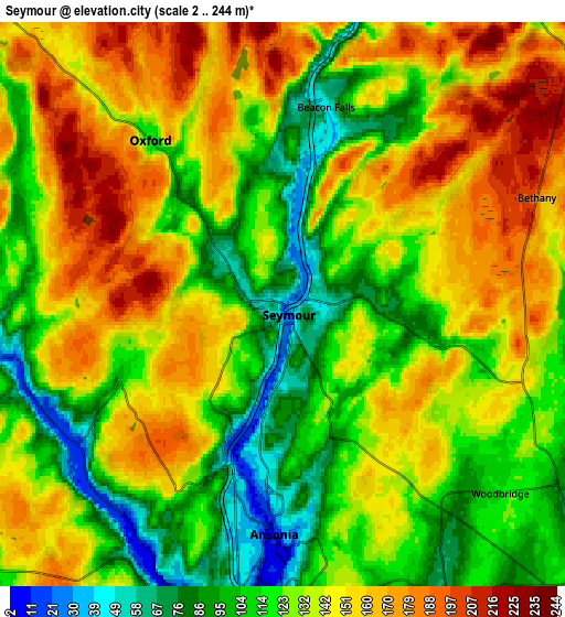
Below is the Elevation map of Seymour, which displays elevation range with different colors. Scale of the first map is from 9 to 232 m (30 to 761 ft) with average elevation of 118.8 meters (=390 ft) [note 1]
These maps also provides idea of topography and contour of this city, they are displayed at different zoom levels. More info about maps, scale and edge coordinates you can find below images.
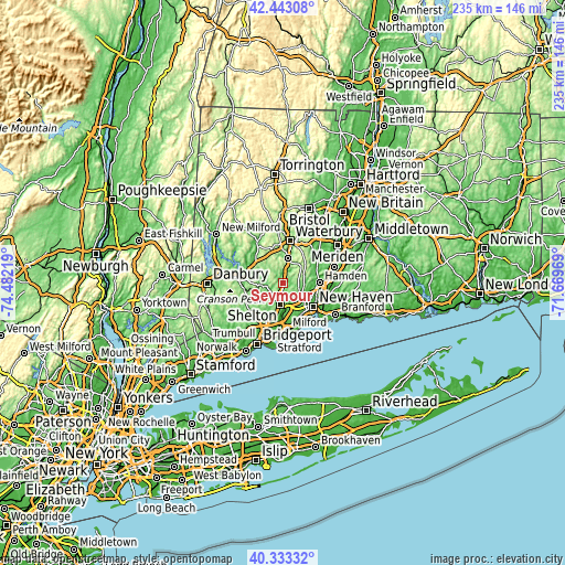
| \ | Map #1 | Map #2 | Topo.Map |
| Scale [m] | 9..232 m | 2..244 m | × |
| Scale [ft] | 30..761 ft | 7..801 ft | × |
| Average | 118.8 m = 390 ft | 133.6 m = 438 ft | × |
| Width | 7.33 km = 4.6 mi | 14.66 km = 9.1 mi | 234.6 km = 145.8 mi |
| Height | 7.33 km = 4.6 mi | 14.66 km = 9.1 mi | 234.6 km = 145.8 mi |
| ↑Max Latitude | 41.429717° | 41.462658° | 42.44308° |
| Latitude at center | 41.39676° | 41.39676° | 41.39676° |
| ↓Min Latitude | 41.363786° | 41.330796° | 40.33332° |
| ← Min Longitude | -73.119885° | -73.163831° | -74.48219° |
| Longitude center | -73.07594° | -73.07594° | -73.07594° |
| →Max Longitude | -73.031995° | -72.988049° | -71.66969° |
Nearby cities:
Cities around Seymour sort by population:
• New Haven elevation 20 m
15.8 km,  128°
128°
• Hamden 32 m
14.9 km,  90°
90°
• Shelton 13 m
9 km,  189°
189°
• Naugatuck 64 m
10.1 km,  11°
11°
• Southbury 77 m
14.8 km,  309°
309°
• Ansonia 19 m
5.6 km,  182°
182°
• Orange 69 m
13.8 km,  162°
162°
• Derby 25 m
8.5 km, 187°
• Oxford 110 m
5.4 km,  320°
320°
• Prospect 268 m
14.3 km,  34°
34°
• Woodbridge 114 m
7.5 km, 131°
• Middlebury 219 m
15.2 km,  343°
343°
Multilingual:
 En español:
Seymour elevación 30 m.
 En France:
Seymour élévation 30 m.


Sources and notes:
- [note 1] Map square and city borders are not equal. Map elevation data is calculated only from area inside that square.
- [src 1] Elevation data from geonames database provided with same terms of usage.
- [src 2] The elevation map of Seymour is generated using elevation data from NASA's 3 arcsec (90m) resolution SRTM data.
- [src 3] Base (background) map © OpenStreetMap contributors tiles are generated by Geofabrik and OpenTopoMap.
Copyright & License:
This Seymour Elevation Map is licensed under CC BY-SA. You may reuse any part from this page, if you give a proper credit by linking to this URL:
 More info on terms of use page.