Canton elevation
Canton (Illinois, Fulton County), United States elevation is 200 meters and Canton elevation in feet is 656 ft above sea level [src 1]. Canton is a populated place (feature code) with elevation that is 79 meters (259 ft) smaller than average city elevation in United States.
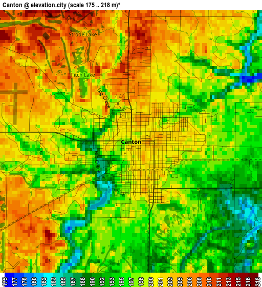
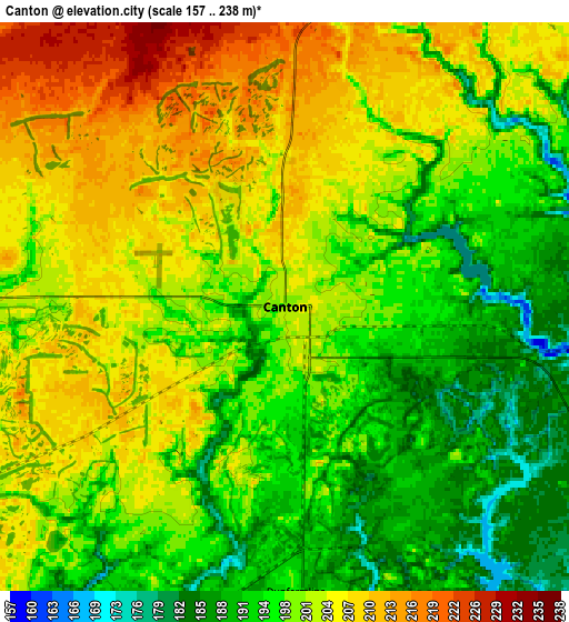
Below is the Elevation map of Canton, which displays elevation range with different colors. Scale of the first map is from 175 to 218 m (574 to 715 ft) with average elevation of 199.4 meters (=654 ft) [note 1]
These maps also provides idea of topography and contour of this city, they are displayed at different zoom levels. More info about maps, scale and edge coordinates you can find below images.
| \ | Map #1 | Map #2 | Topo.Map |
| Scale [m] | 175..218 m | 157..238 m | × |
| Scale [ft] | 574..715 ft | 515..781 ft | × |
| Average | 199.4 m = 654 ft | 199.8 m = 656 ft | × |
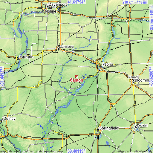
| Width | 7.42 km = 4.6 mi | 14.85 km = 9.2 mi | 237.6 km = 147.6 mi |
| Height | 7.42 km = 4.6 mi | 14.85 km = 9.2 mi | 237.6 km = 147.6 mi |
| ↑Max Latitude | 40.591469° | 40.624831° | 41.61794° |
| Latitude at center | 40.55809° | 40.55809° | 40.55809° |
| ↓Min Latitude | 40.524694° | 40.491282° | 39.48119° |
| ← Min Longitude | -90.079065° | -90.123011° | -91.44137° |
| Longitude center | -90.03512° | -90.03512° | -90.03512° |
| →Max Longitude | -89.991175° | -89.947229° | -88.62887° |
Nearby cities:
Cities around Canton sort by population:
• Pekin elevation 155 m
33.3 km,  88°
88°
• Havana 150 m
28.8 km,  184°
184°
• Farmington 228 m
15.8 km,  8°
8°
• Lewistown 180 m
21 km,  208°
208°
• Elmwood 195 m
25.1 km, 13°
• Bellevue 206 m
33.1 km,  64°
64°
• Lake Camelot 184 m
26 km,  71°
71°
• Manito 153 m
26.2 km,  124°
124°
• Hanna City 223 m
25.1 km,  53°
53°
• Cuba 208 m
15 km,  241°
241°
• South Pekin 158 m
33.2 km,  102°
102°
• Glasford 188 m
18.8 km, 85°
Multilingual:
 En español:
Canton elevación 200 m.
 En France:
Canton élévation 200 m.


Sources and notes:
- [note 1] Map square and city borders are not equal. Map elevation data is calculated only from area inside that square.
- [src 1] Elevation data from geonames database provided with same terms of usage.
- [src 2] The elevation map of Canton is generated using elevation data from NASA's 3 arcsec (90m) resolution SRTM data.
- [src 3] Base (background) map © OpenStreetMap contributors tiles are generated by Geofabrik and OpenTopoMap.
Copyright & License:
This Canton Elevation Map is licensed under CC BY-SA. You may reuse any part from this page, if you give a proper credit by linking to this URL:
 More info on terms of use page.